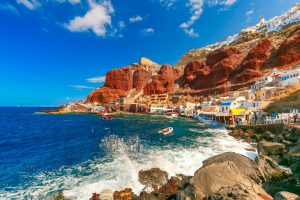
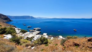
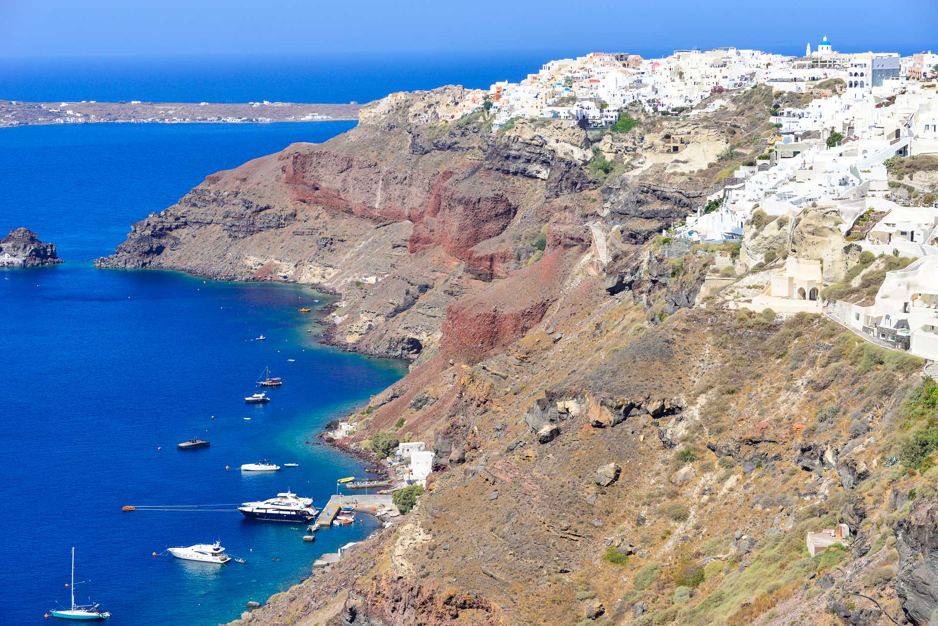
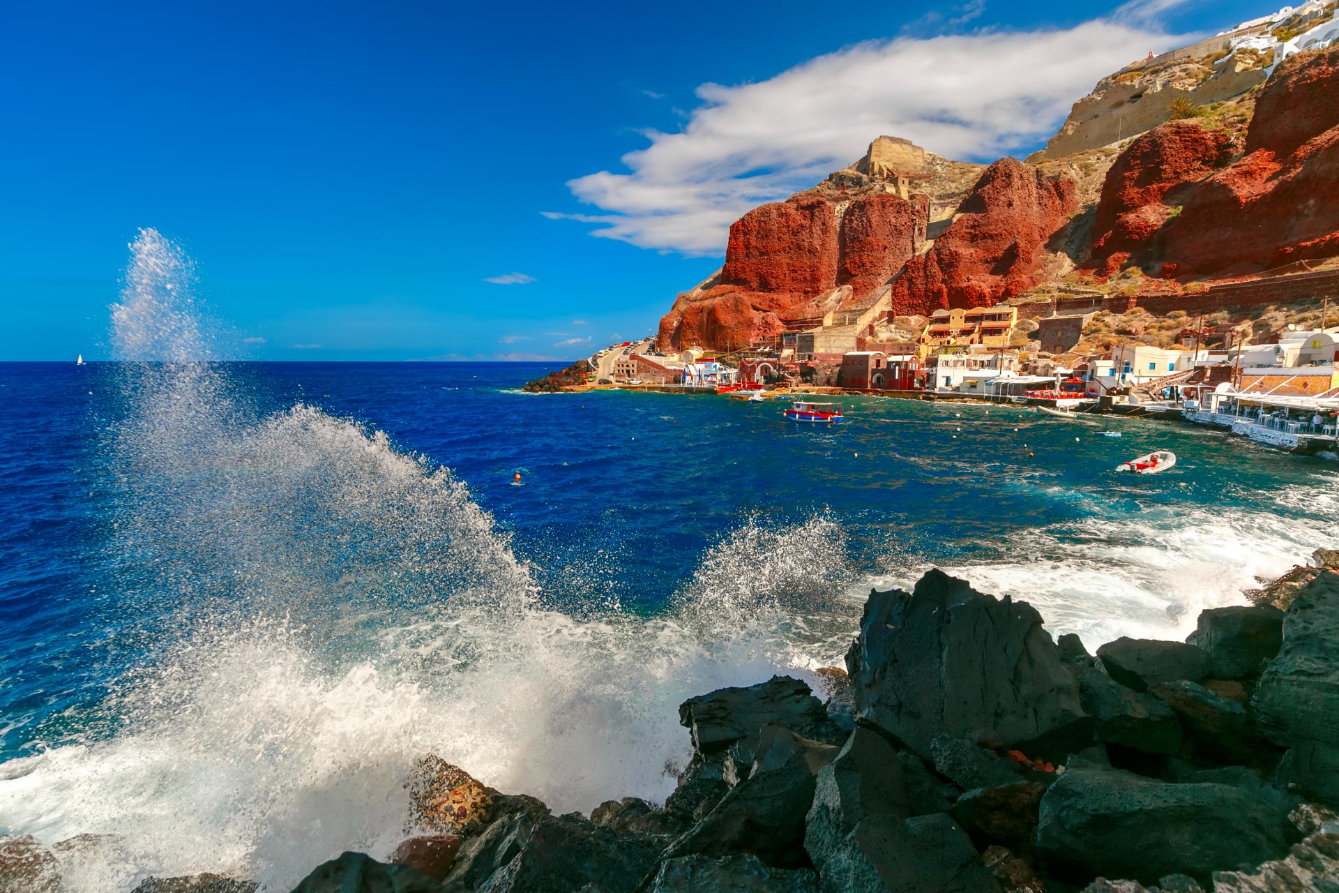
Welcome to
Our portal
about Santorini!

Oia

Oia - Table of Contents

Oia is one of the most popular and picturesque towns on the island. An absolute must see during a trip to Santorini. It is located on the north-west edge of the island, at an altitude of 70 to 140 m a.s.l. (230 – 460 feet). Its characteristic white buildings stretch for about 1.5 km (1 mile) along the edge of the cliff over the Armenis Bay.

From the west, Oia is adjacent to fishing village of Amoudi (Greek: Αμμουδίου). On its south there is a port village of Armeni (Greek: Αρμένη), on its east side Finikia (Greek Φοινικιά) and from the north Tholos (Greek: Θόλος). It is 12 km (7.5 miles) from the island’s capital Fira and 17 km (10.5 miles) from the airport.

The peninsula on which Oia is located is limited from the west by the 331 m a.s.l. high volcanic peak of Mavro Vouno (Greek Μαύρο Βουνό) and 293 m a.s.l. high peak of Kokkino Vouno (Greek Κοκκινό Βουνό) (More on this topic: Volcanoes Mavro Vouno and Kokkingo Vouno)

Oia belongs to the administration of the Aegean Islands, South Aegean region, the regional unit of Oia, of which it is the capital. In addition to Oia with its neighboring towns, the Oia regional unit also includes the second inhabited island of the archipelago – Thirassia.

Top attractions of Oia

Amoudi Bay

The bay and port of Amoudi is located on the northwestern tip of the island of Santorini, on the seafront below the town of Oia. The white buildings of the Amoudi town built into the blood-red slope of the caldera cliff look very picturesque.
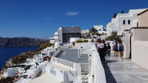
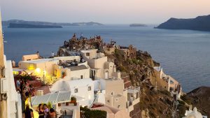
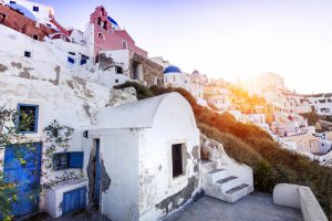
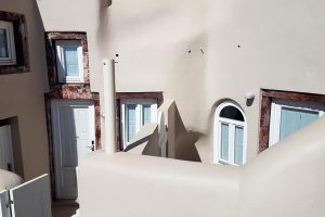
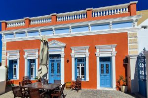
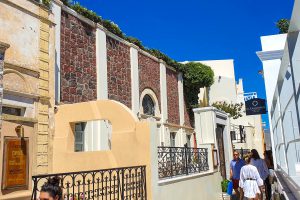
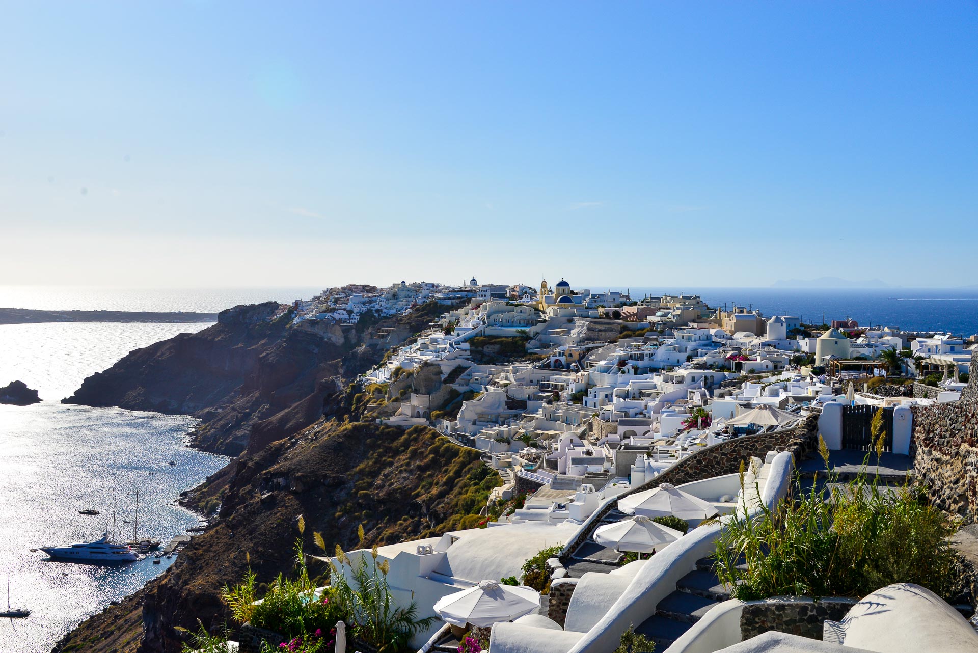
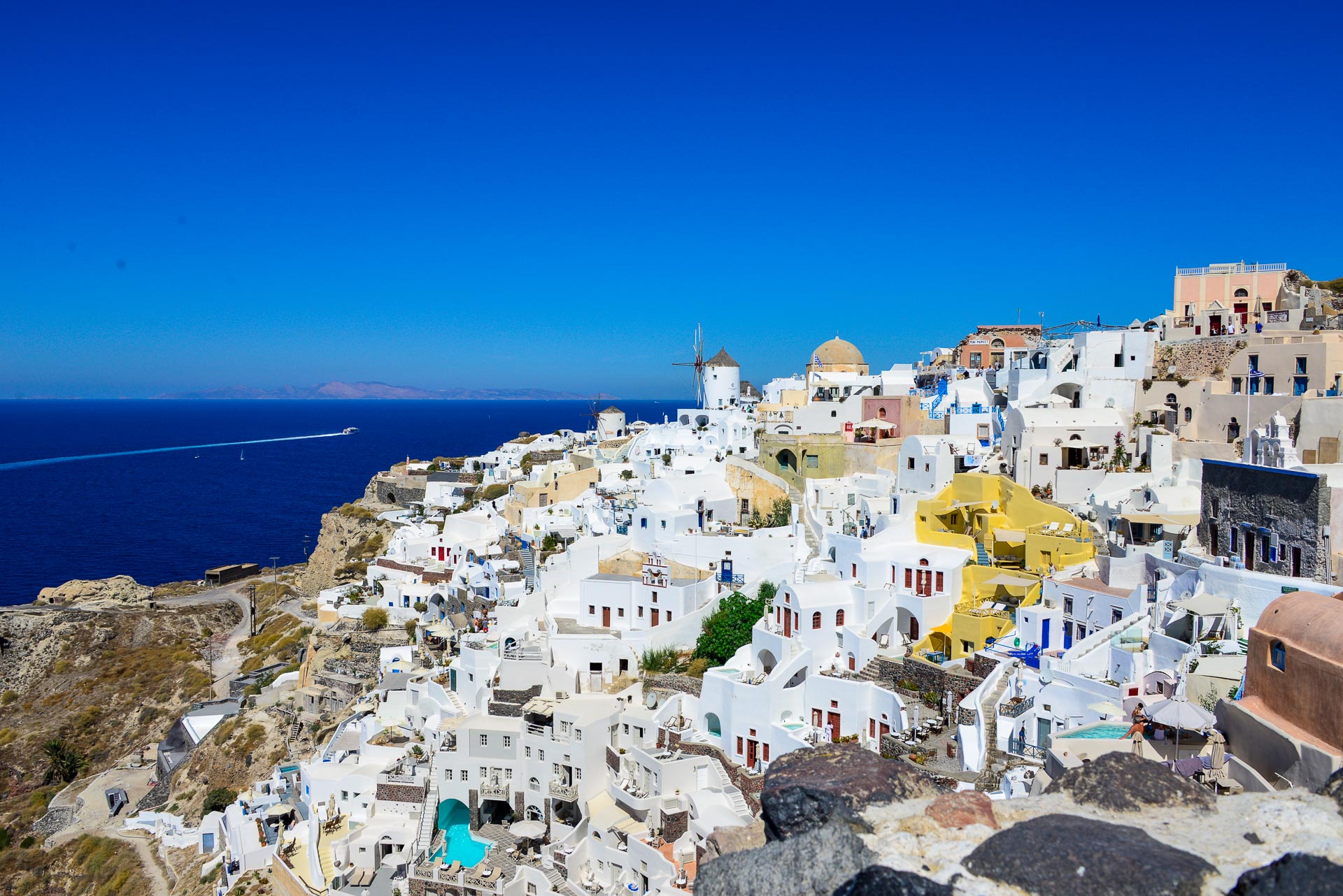
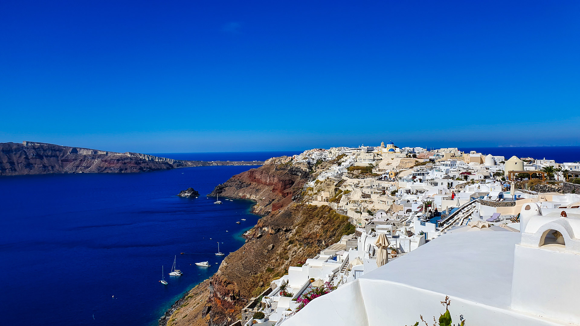
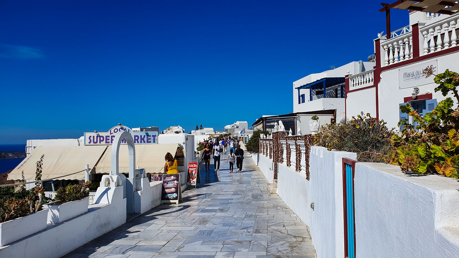
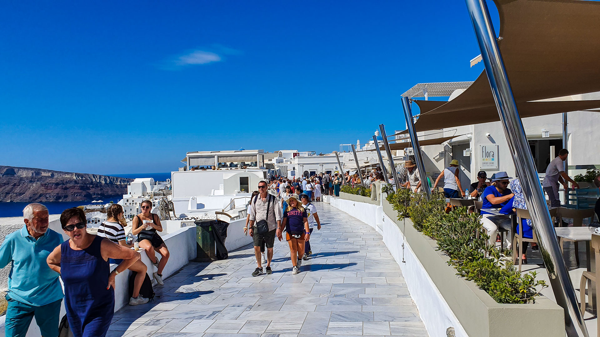
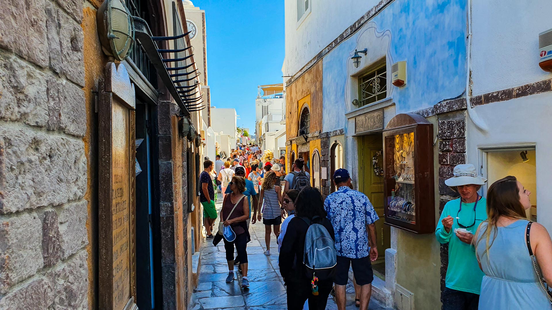
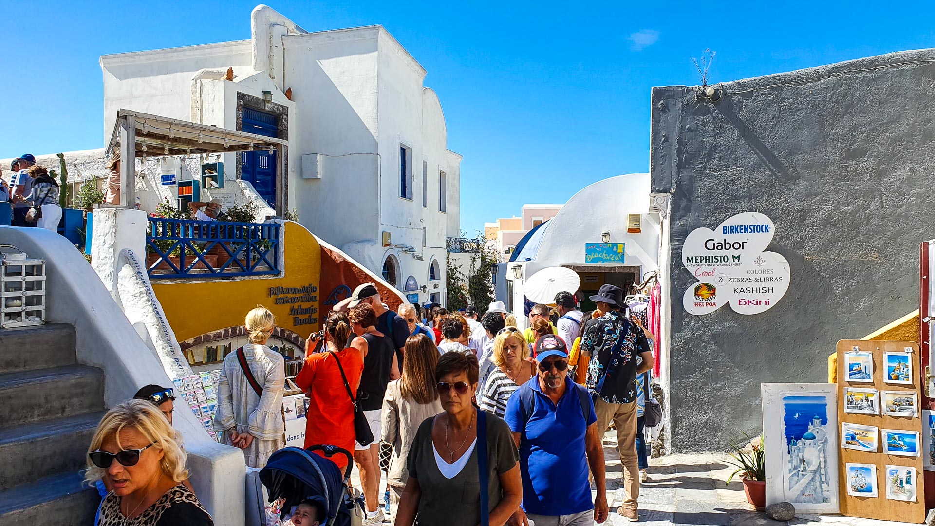
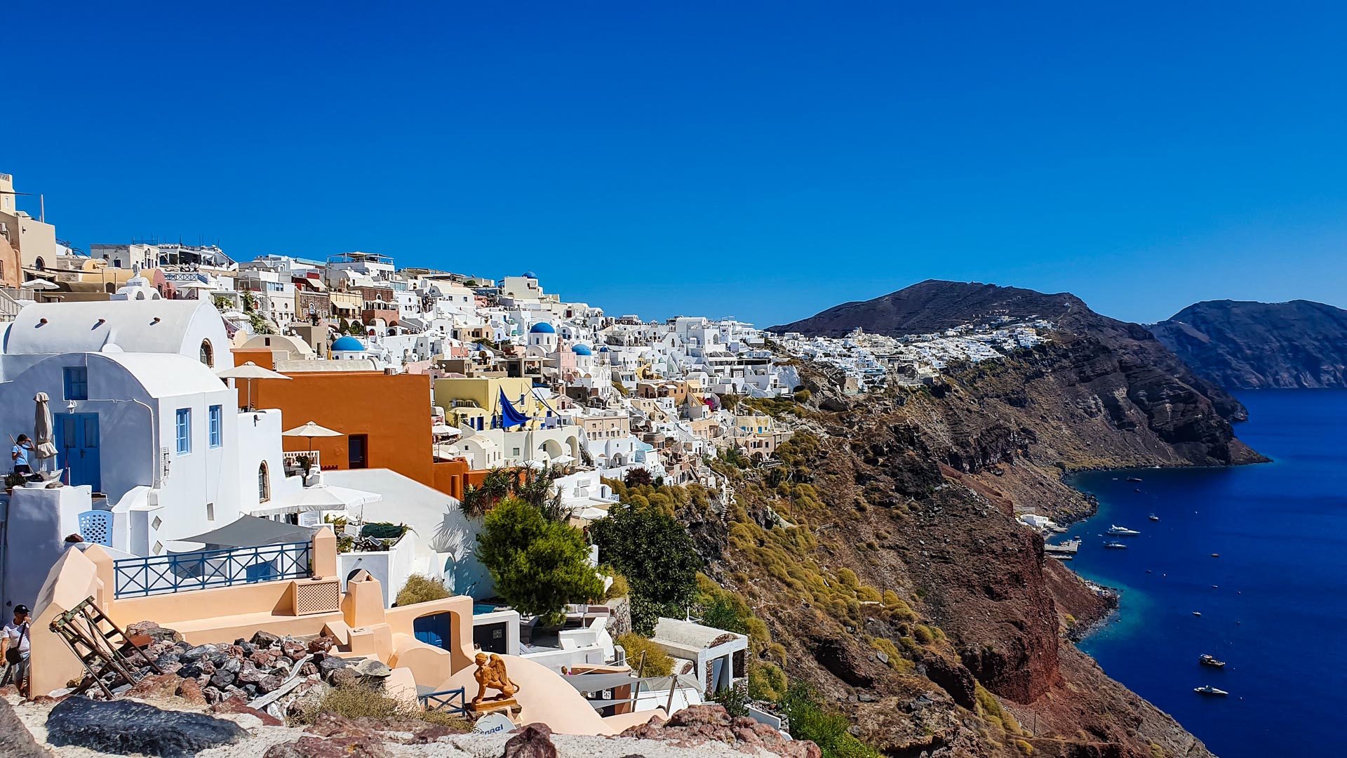
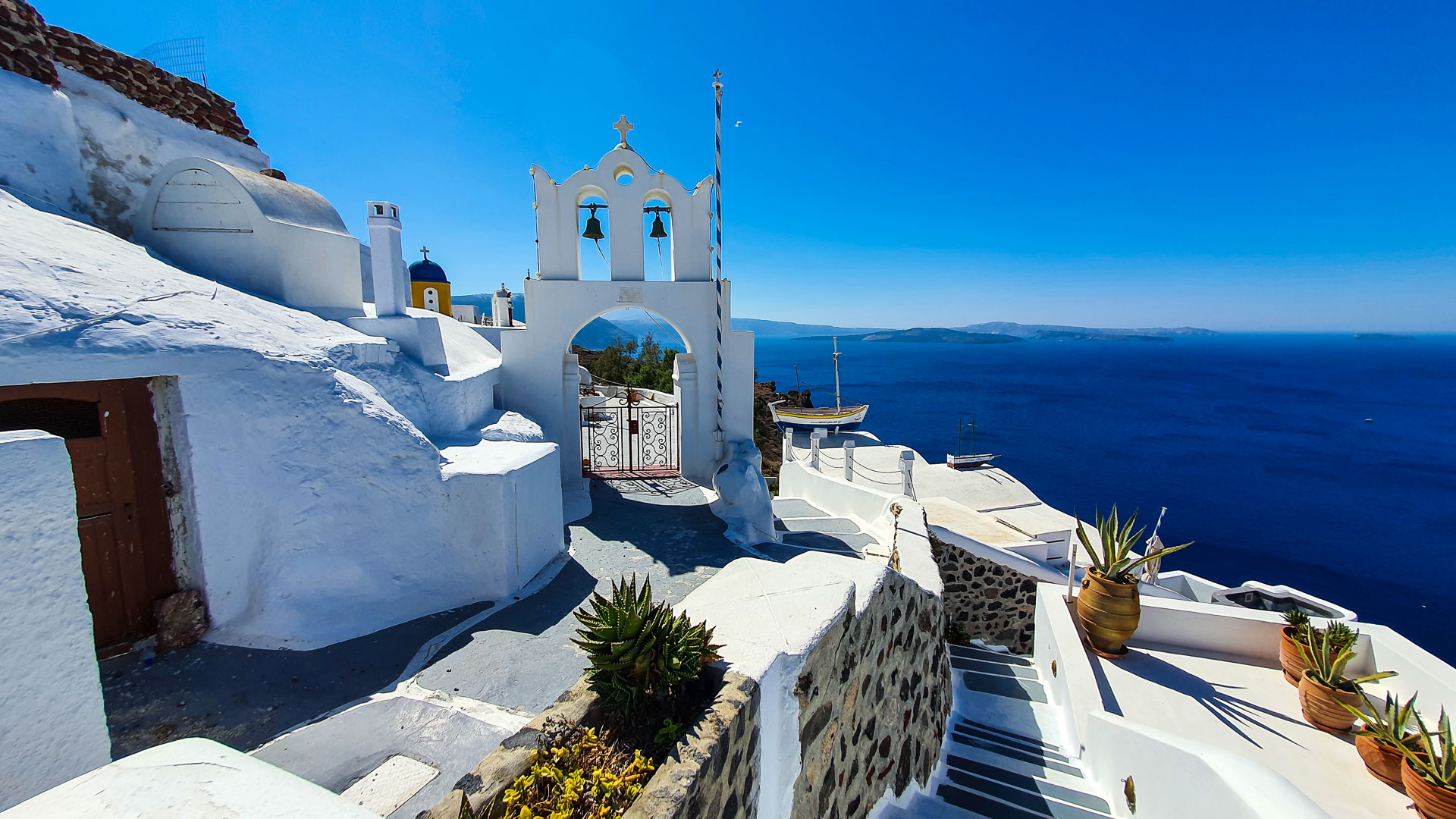
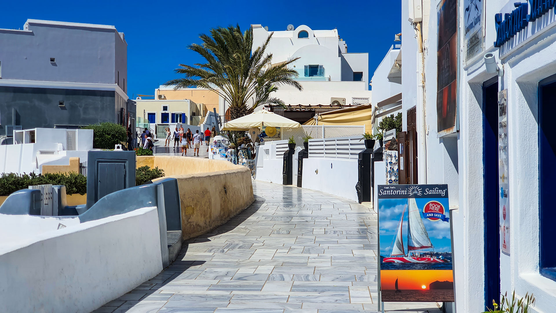
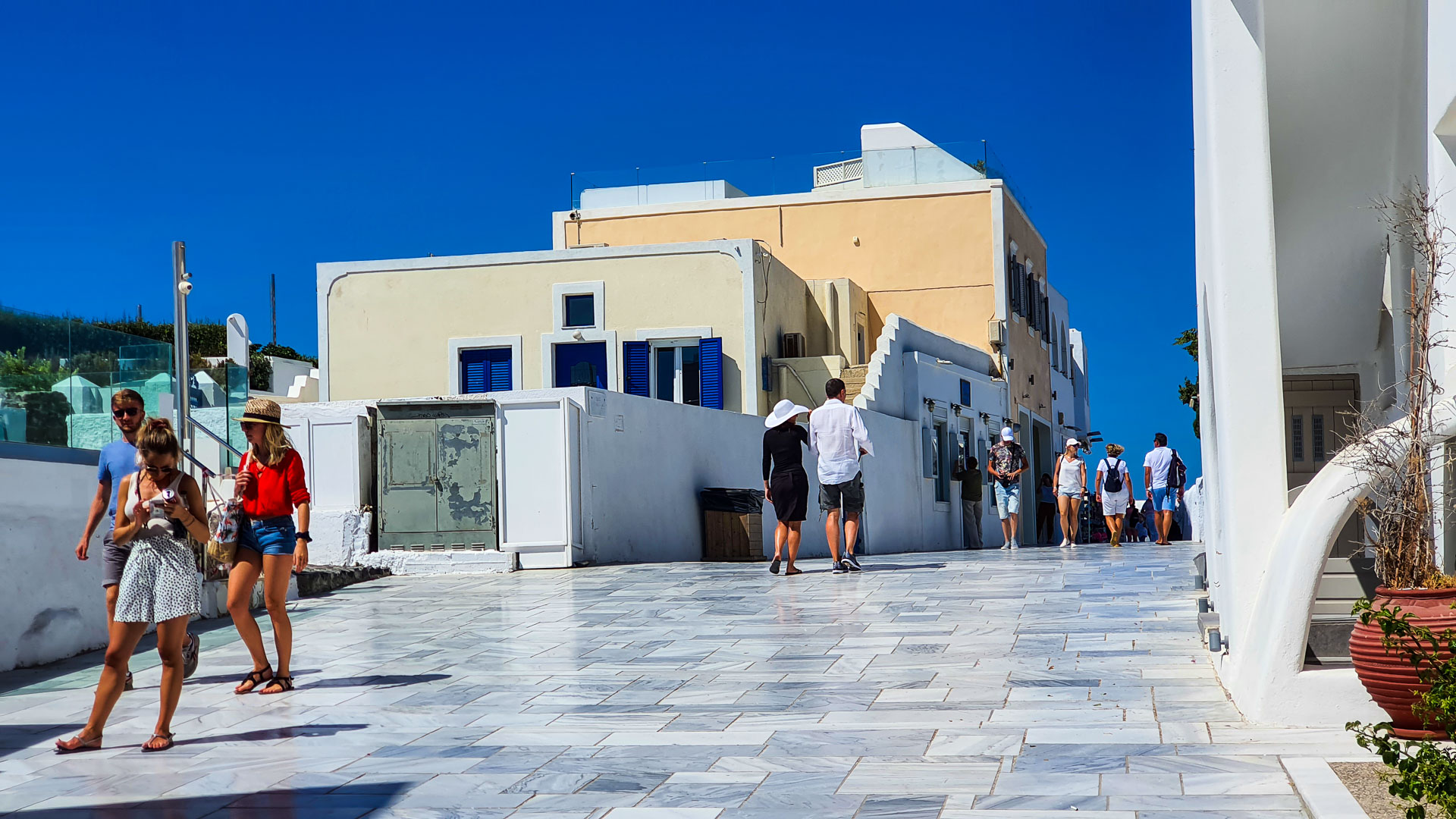
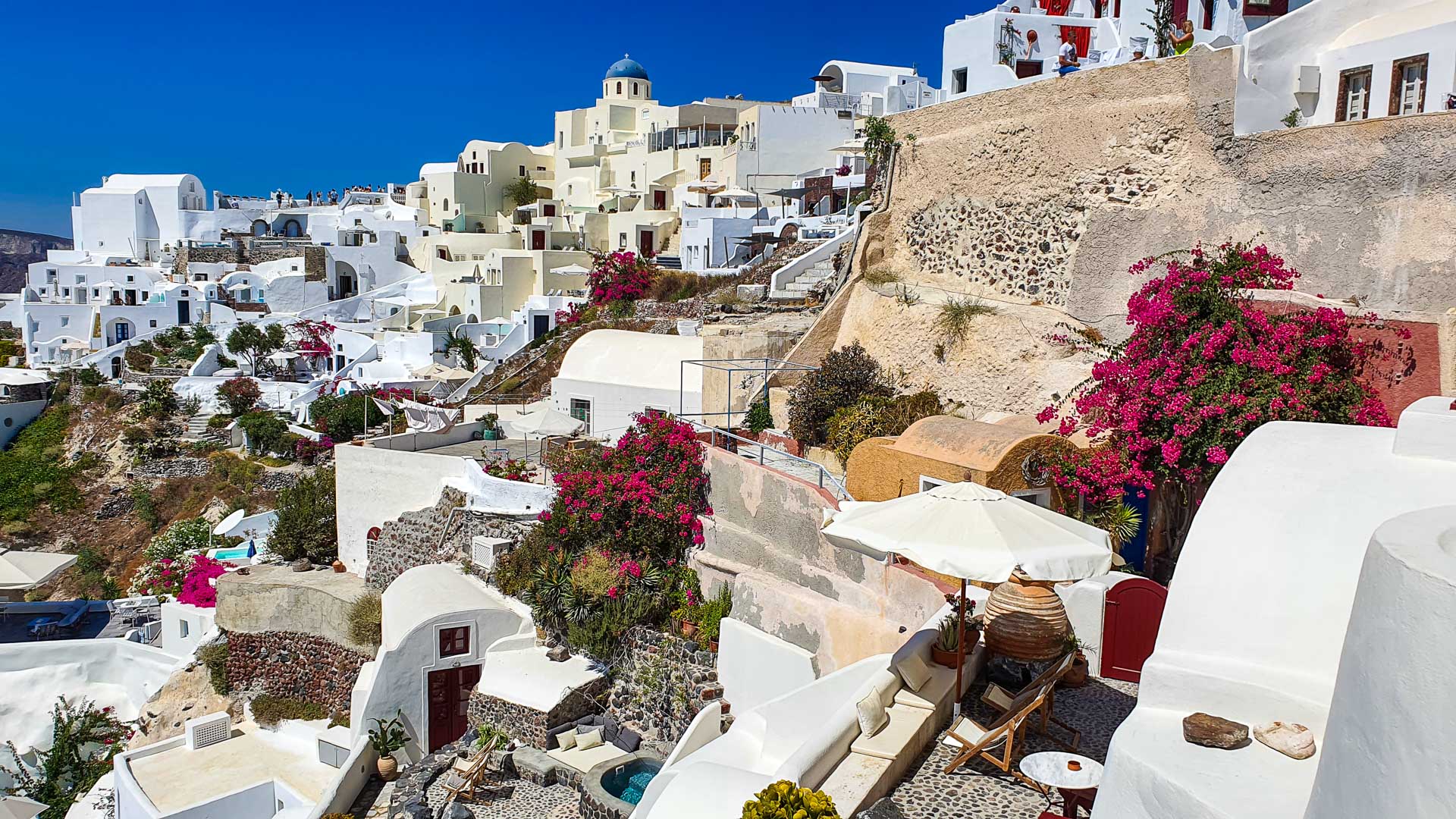
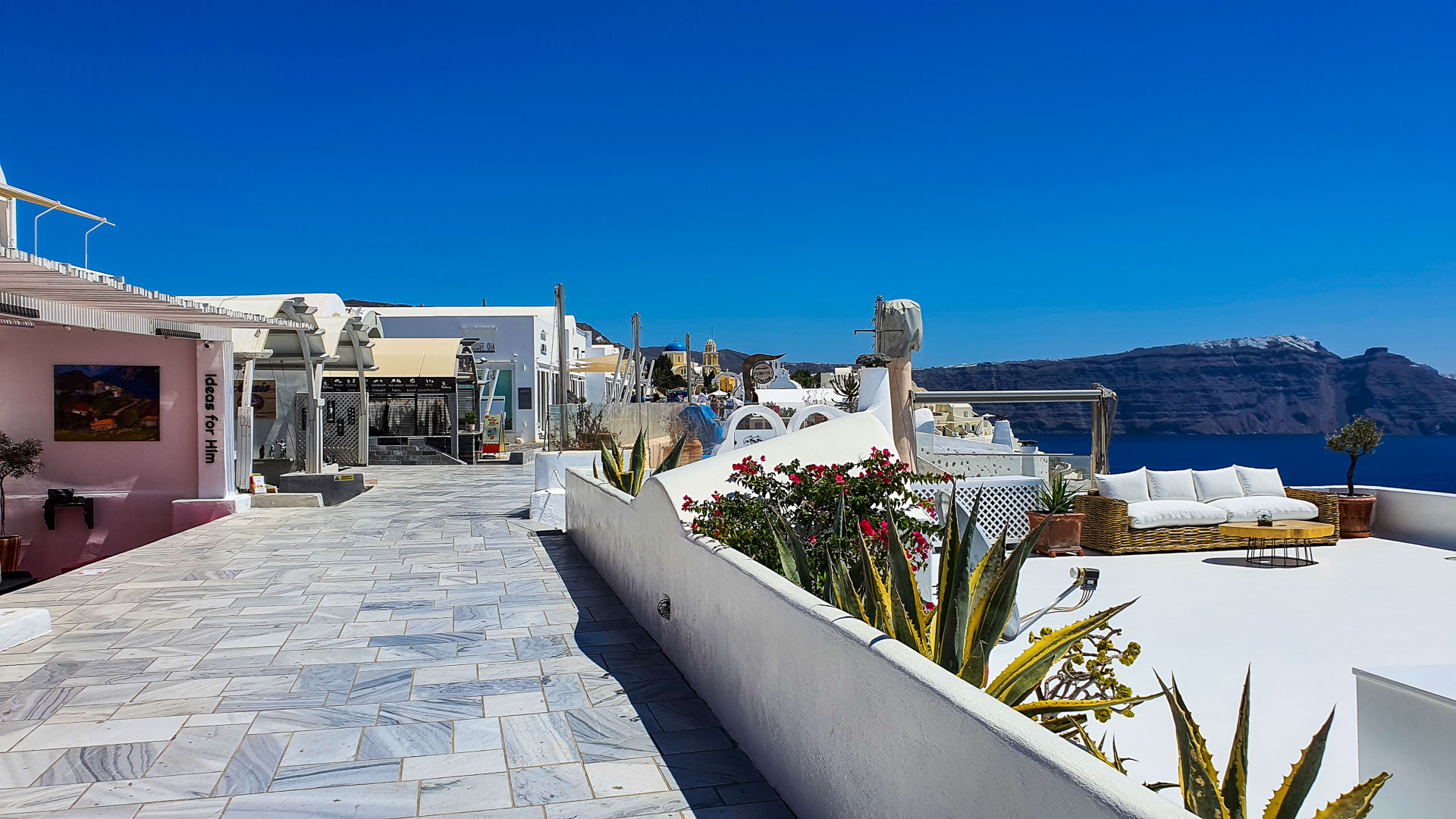
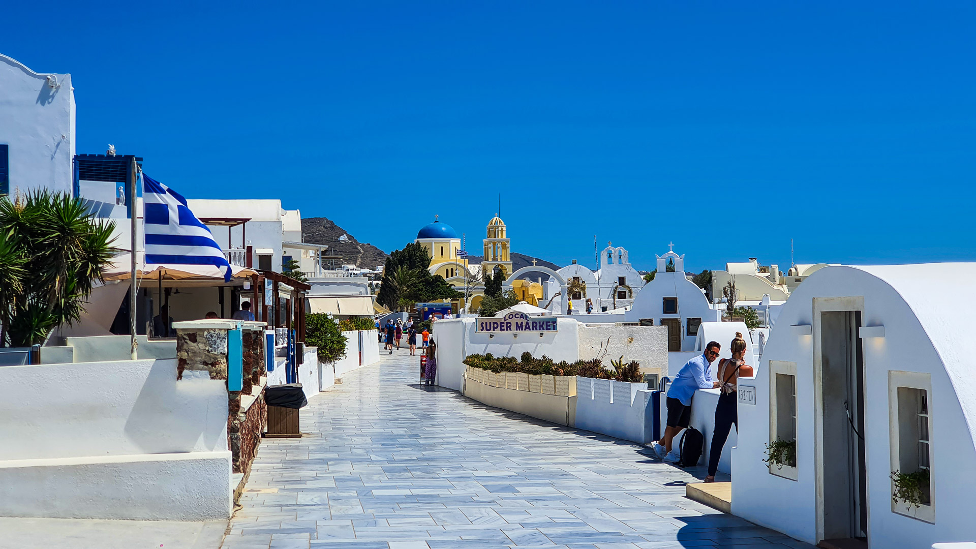
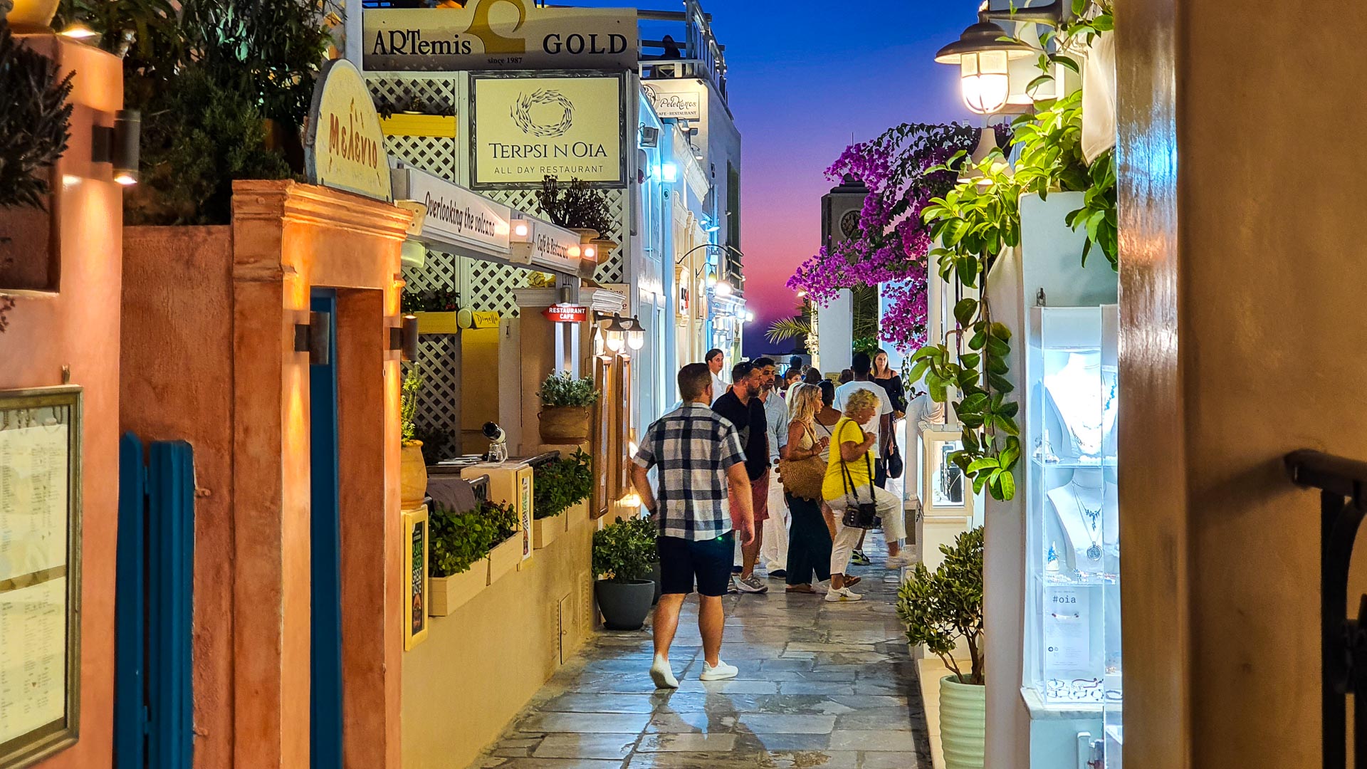
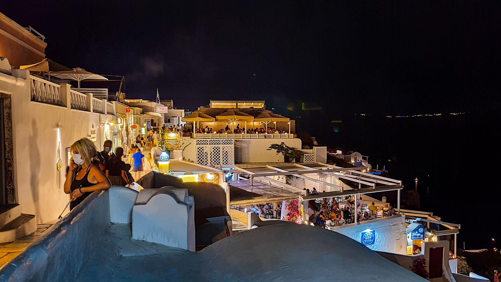
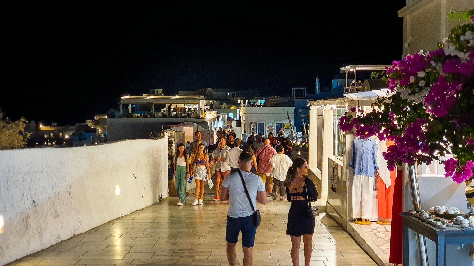
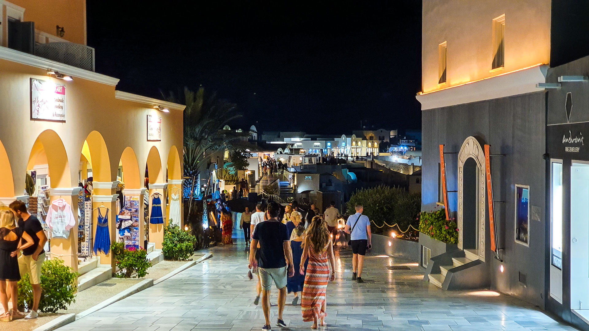
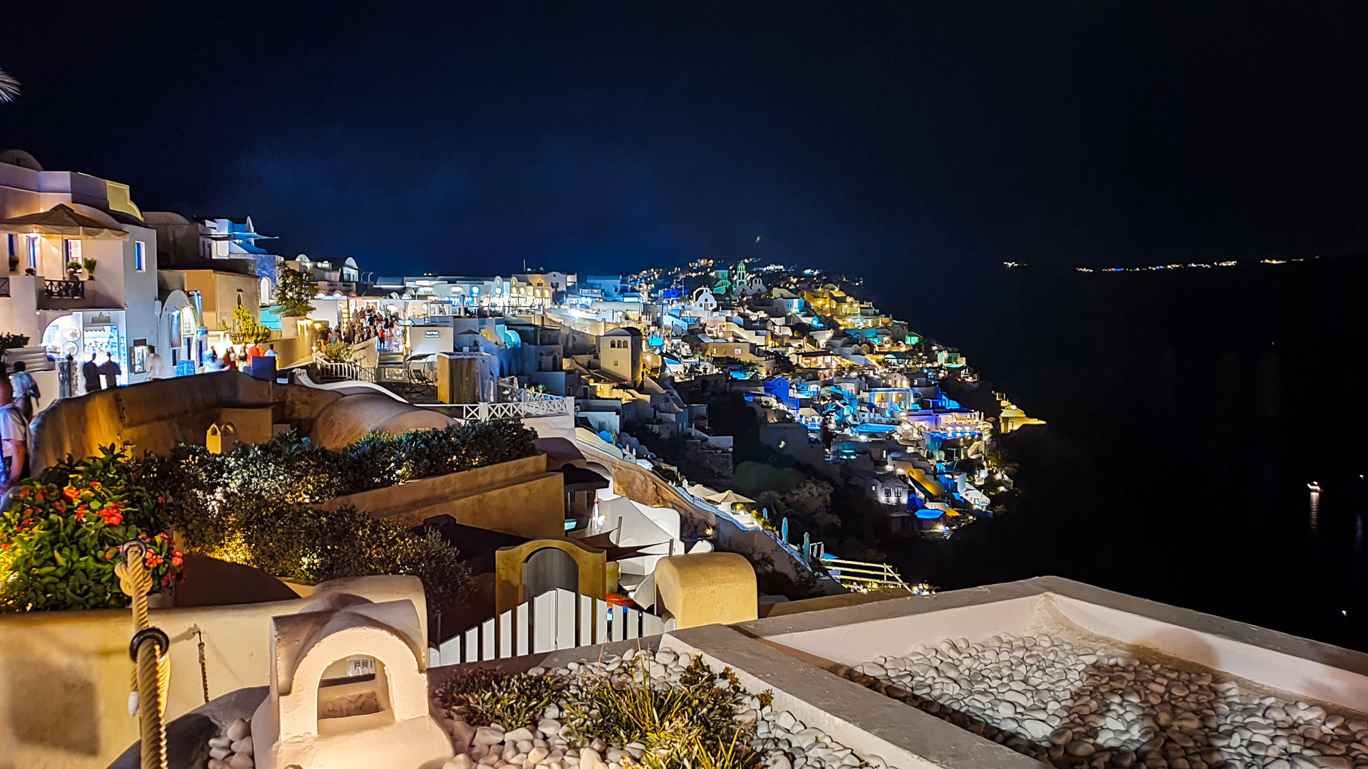
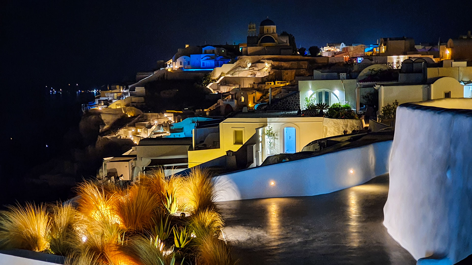
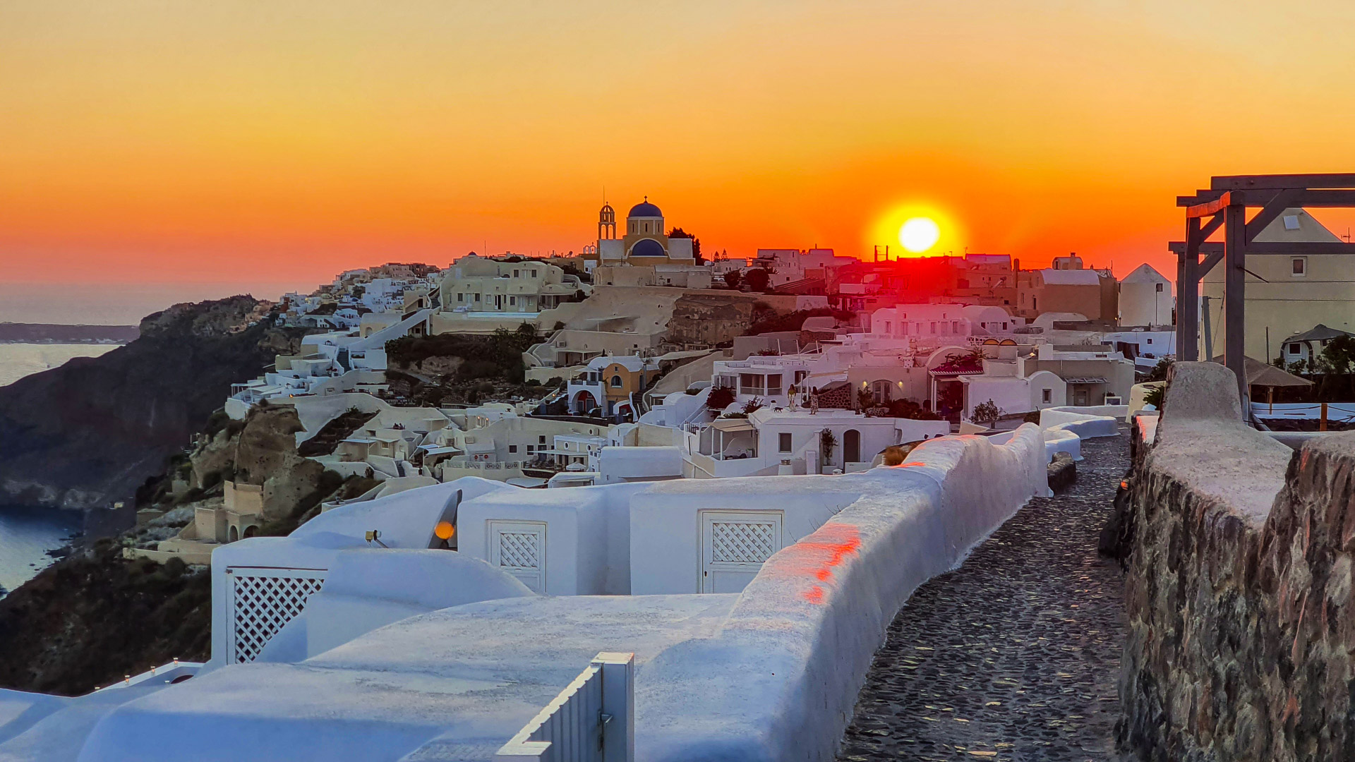
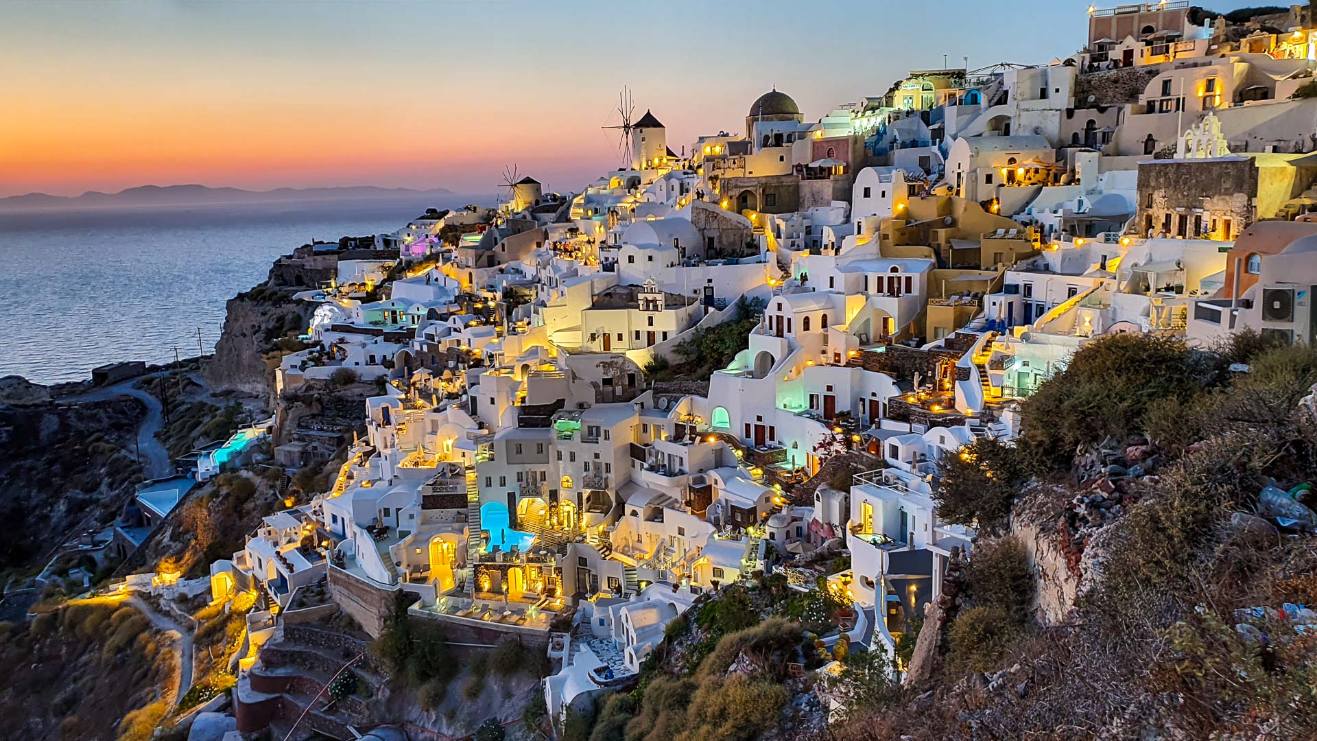
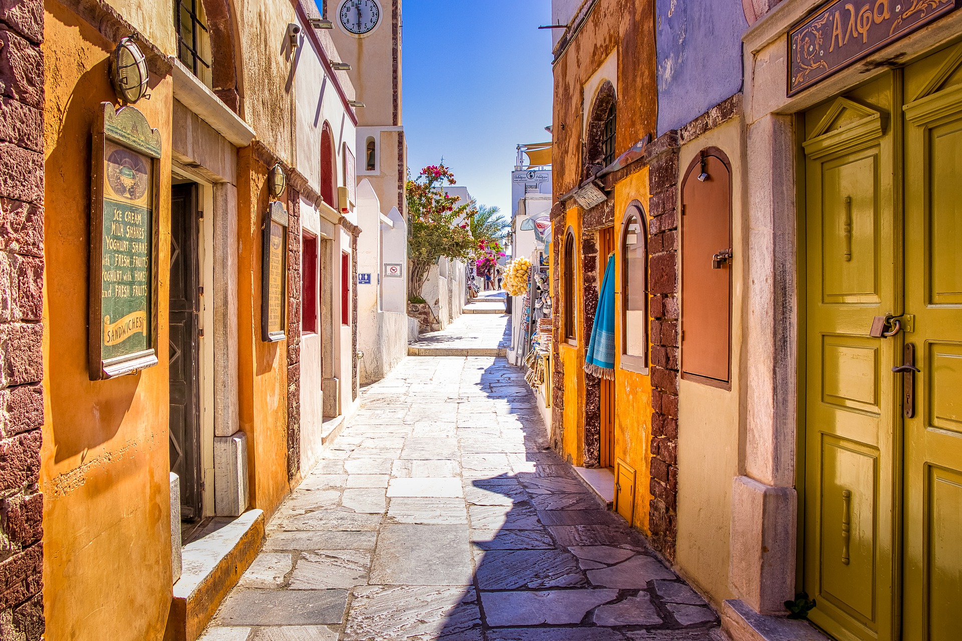
READ MORE »

Oia’s Main Street

The promenade stretches along the whole town, and delivers beautiful views of the entire caldera. The most known and representative part (Nikolaou Nomikou Street) is lined with 19th-century marble.

READ MORE »

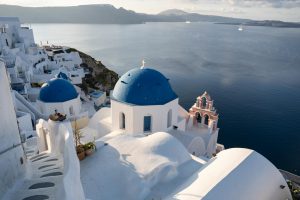
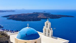
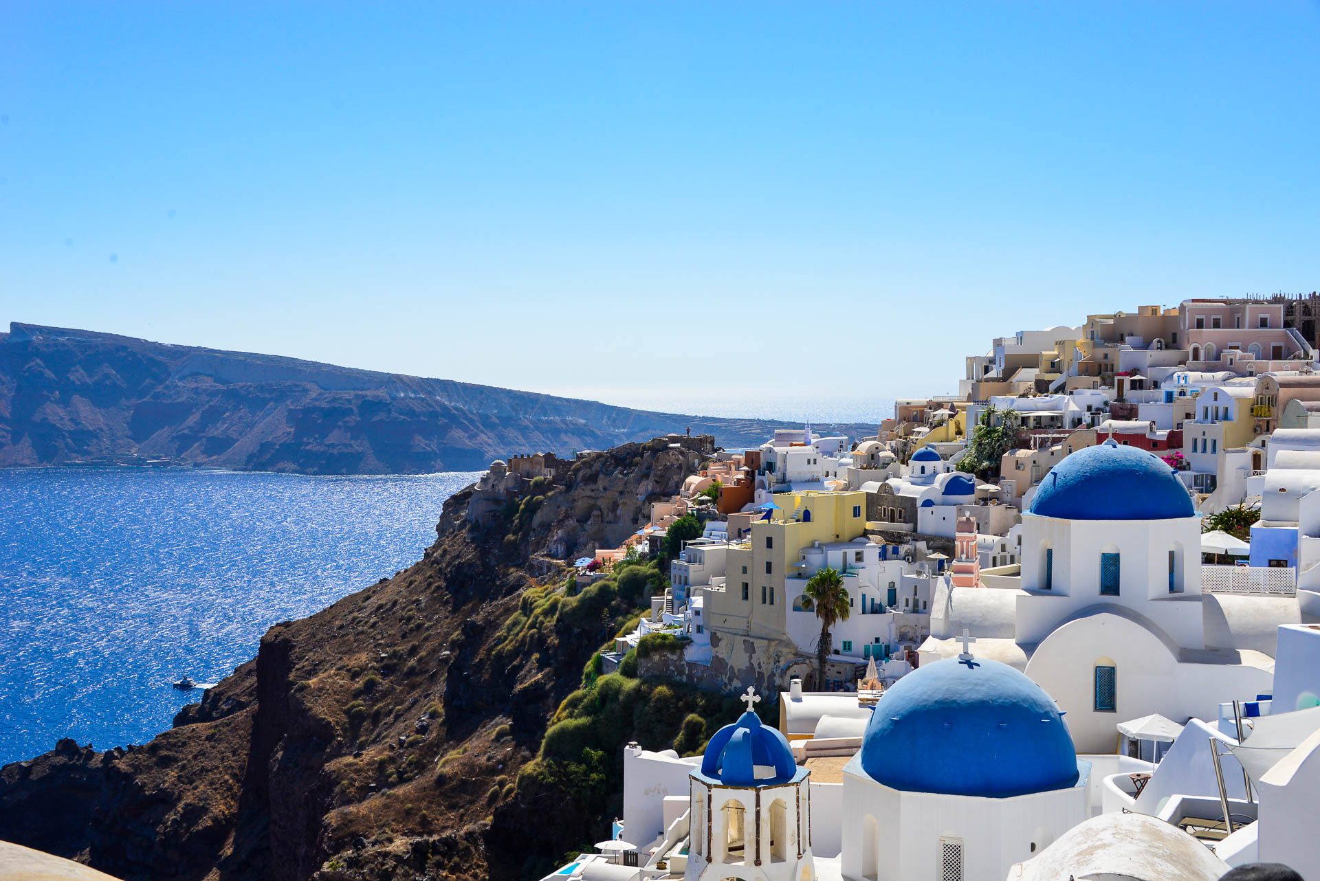
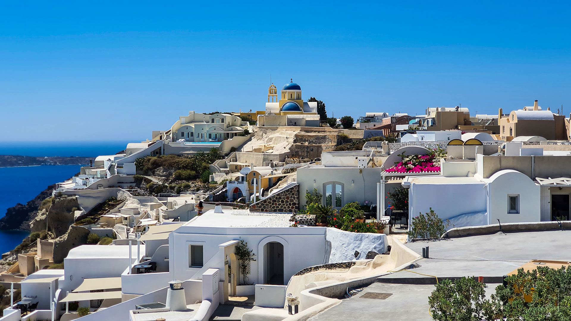
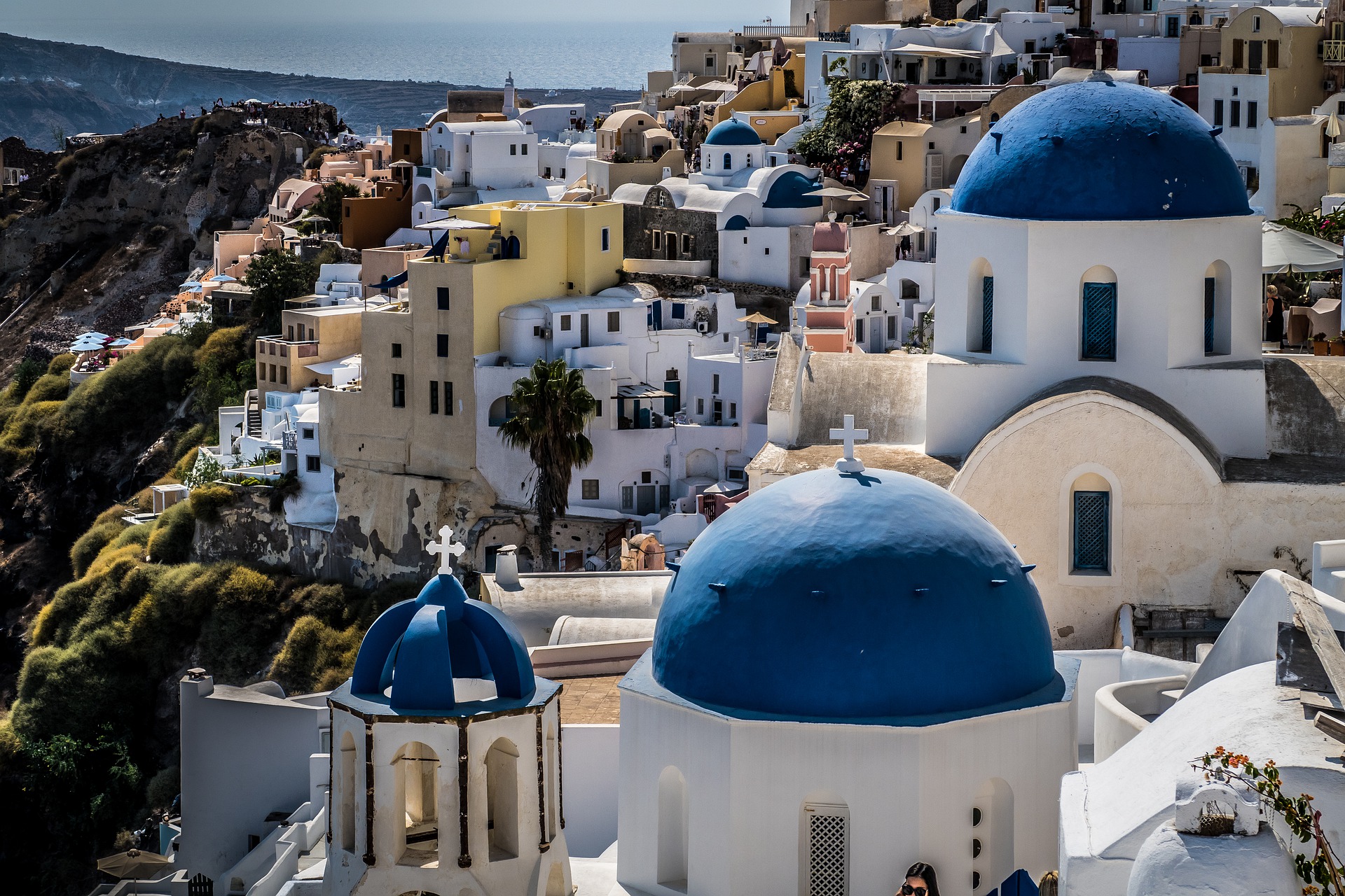
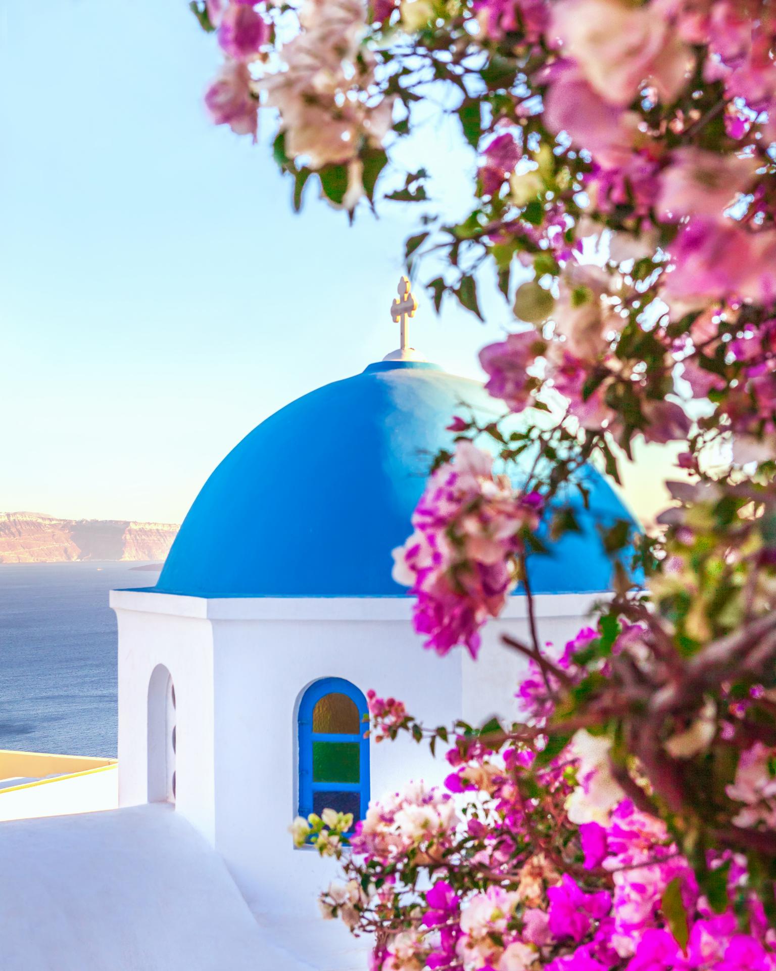
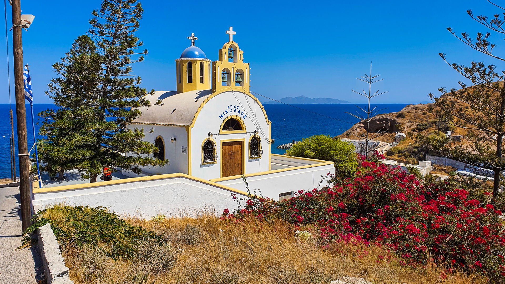
Churches of St. Anastasi and St. Spirydon in Oia

Two picturesque churches next to each other built on the slope of the caldera. They are located in the west of Oia, south of the main promenade that runs through the city (from the caldera). With characteristic blue domes, they are one of the most photogenic churches in Oia.
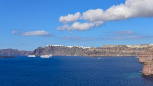
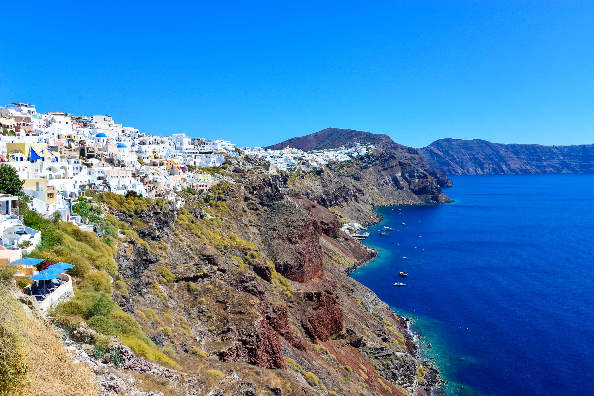
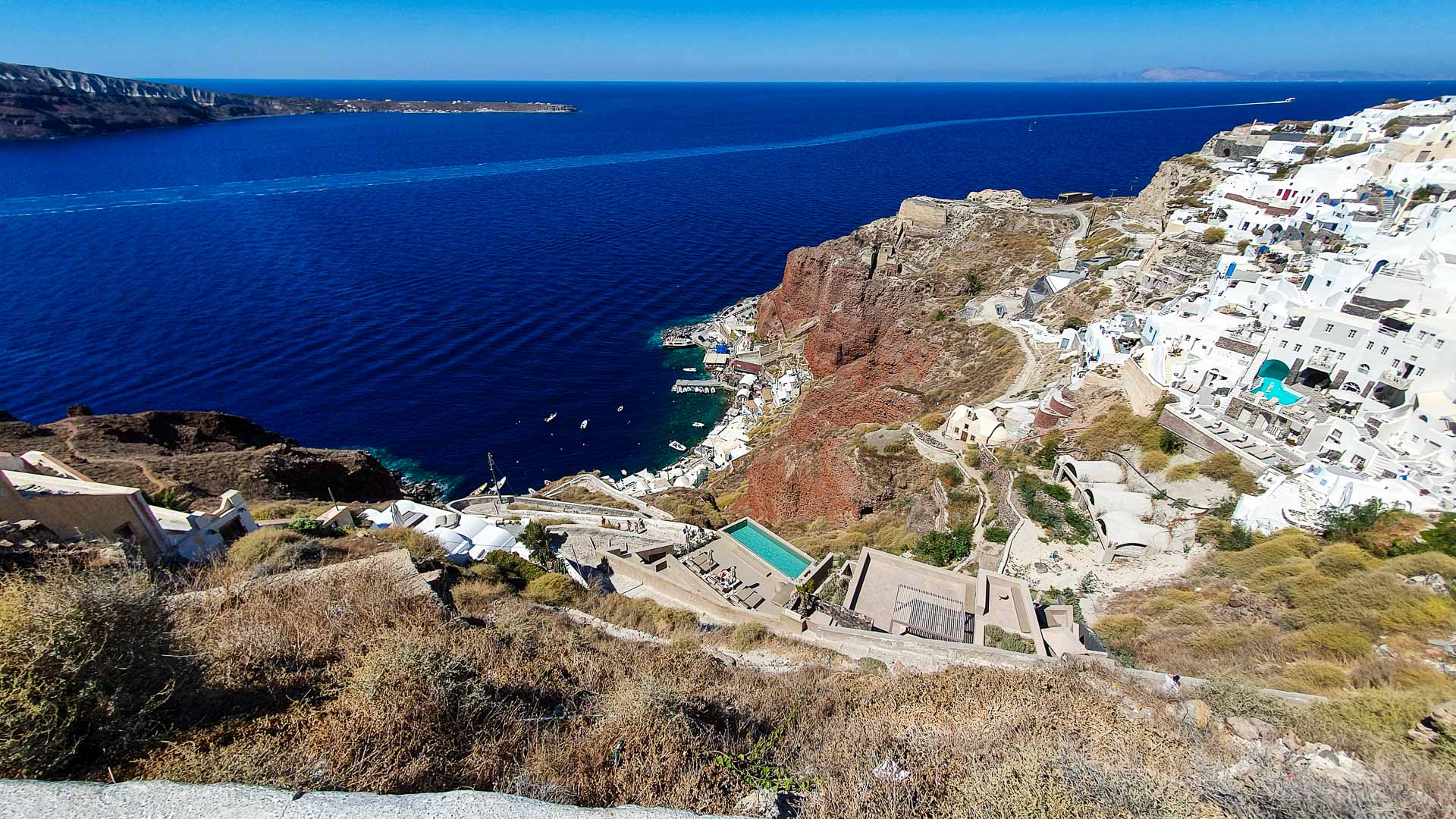
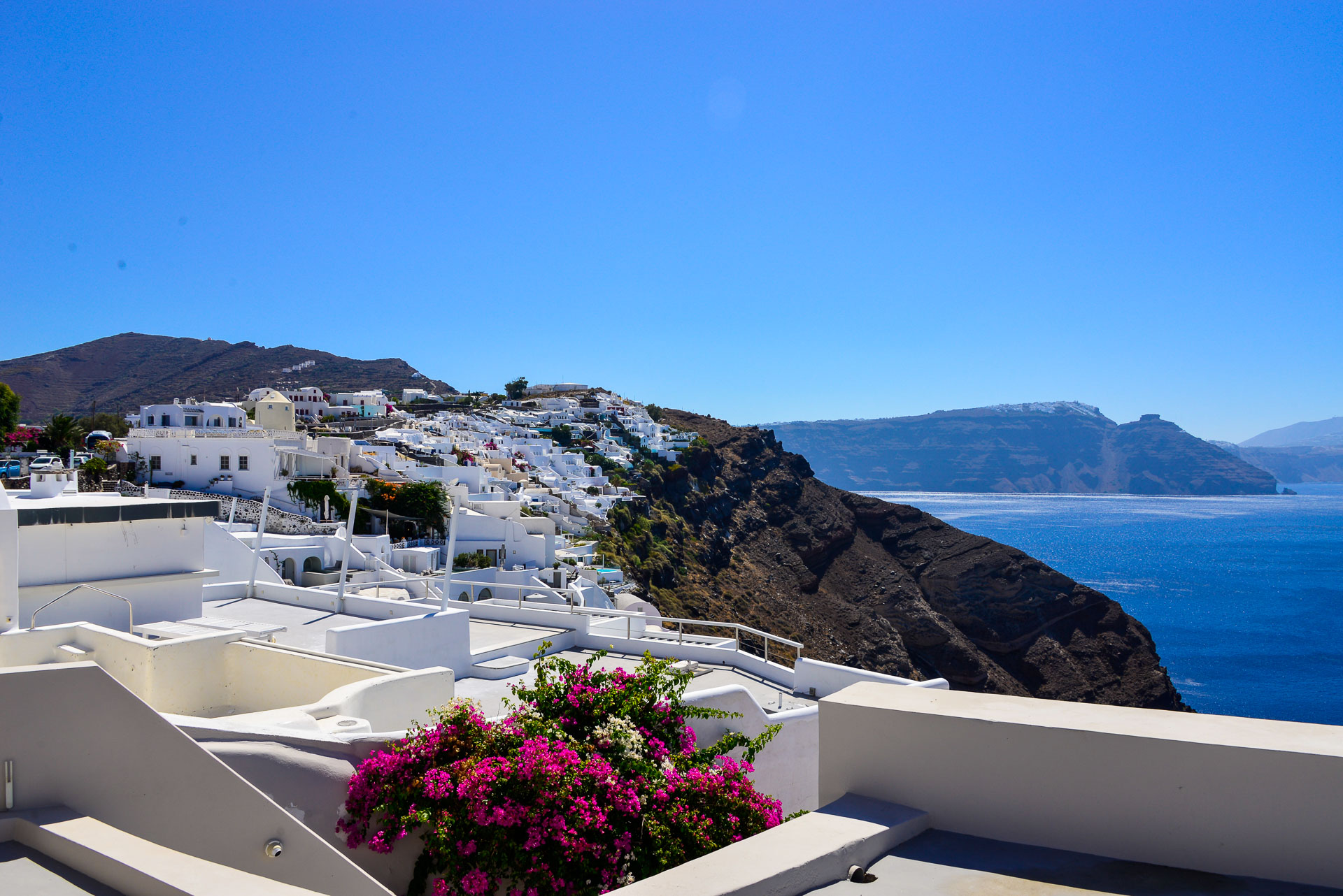
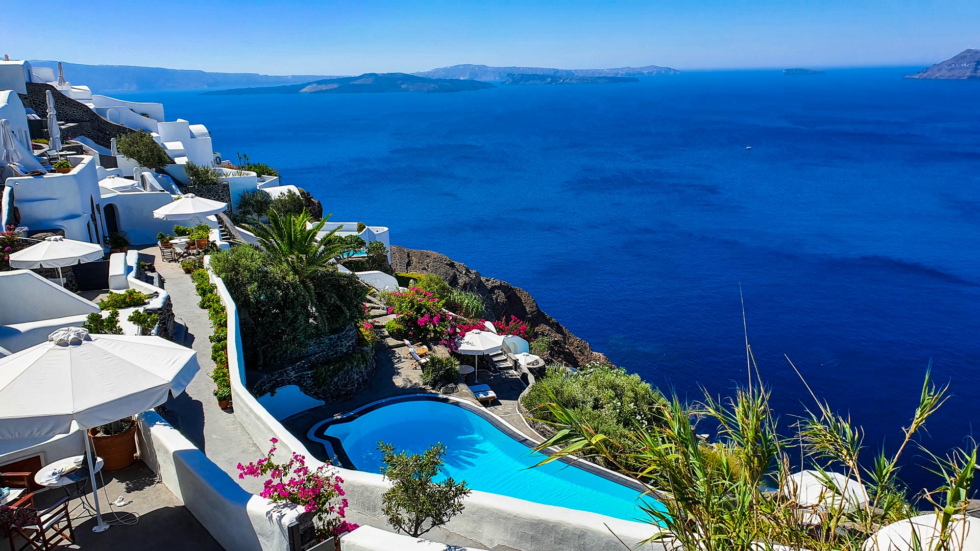
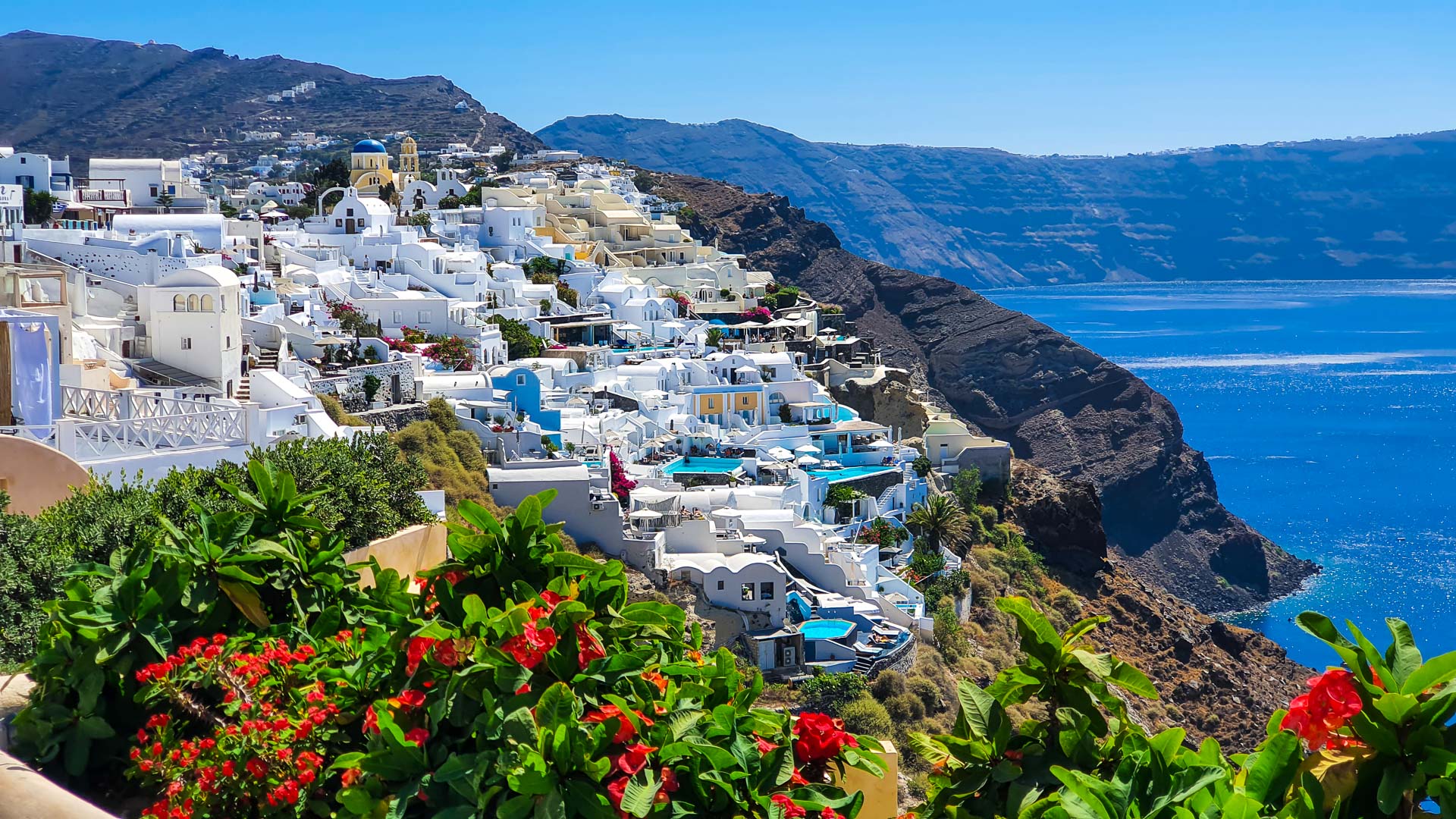
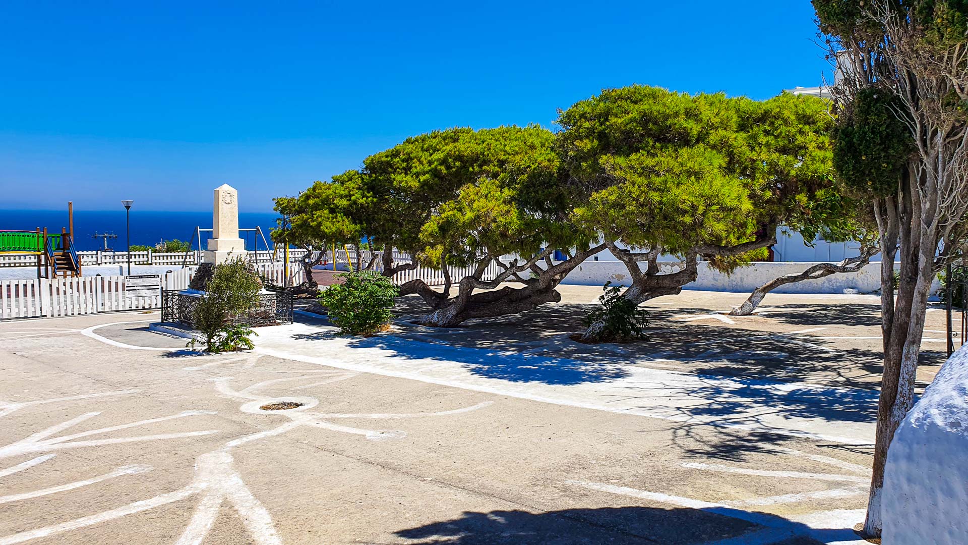
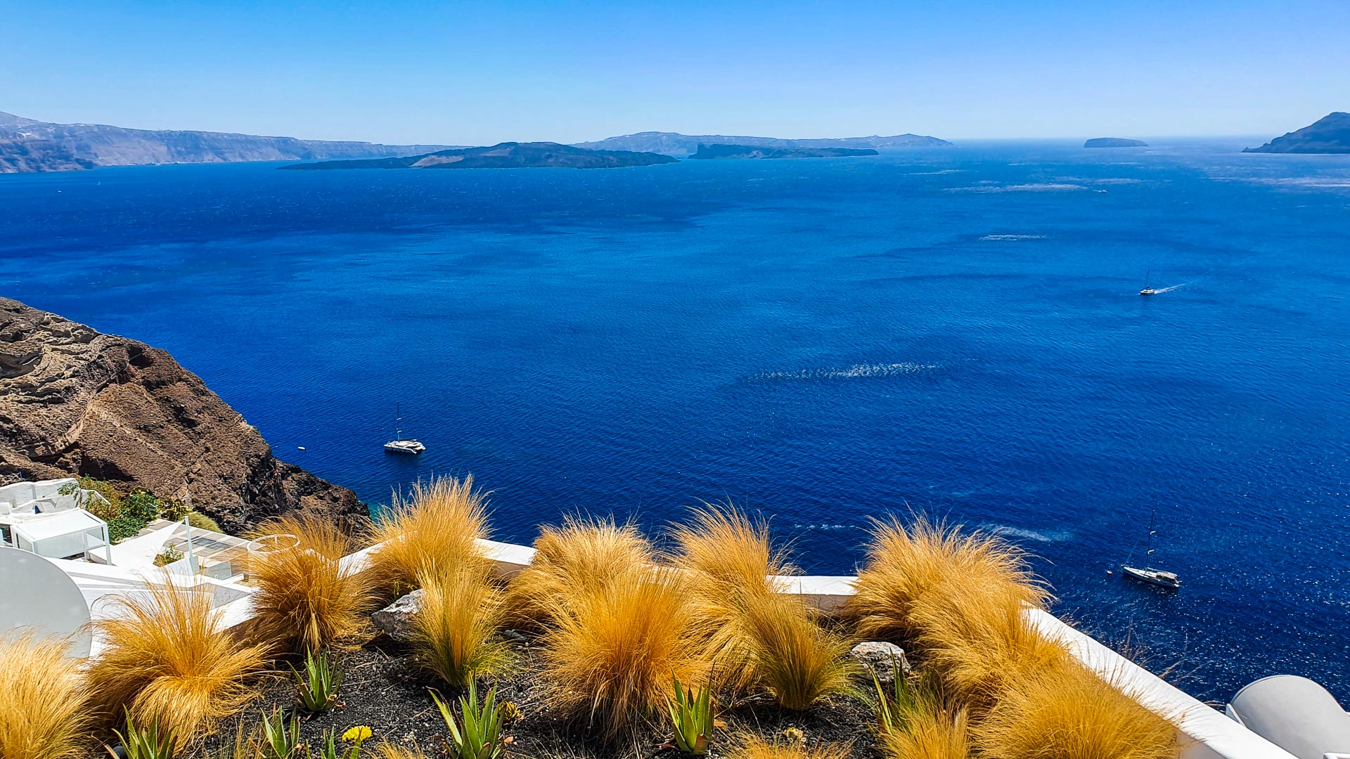
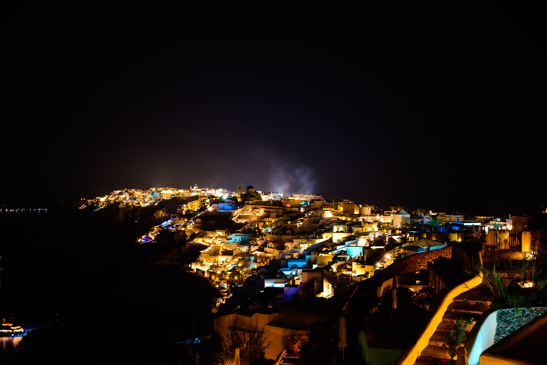
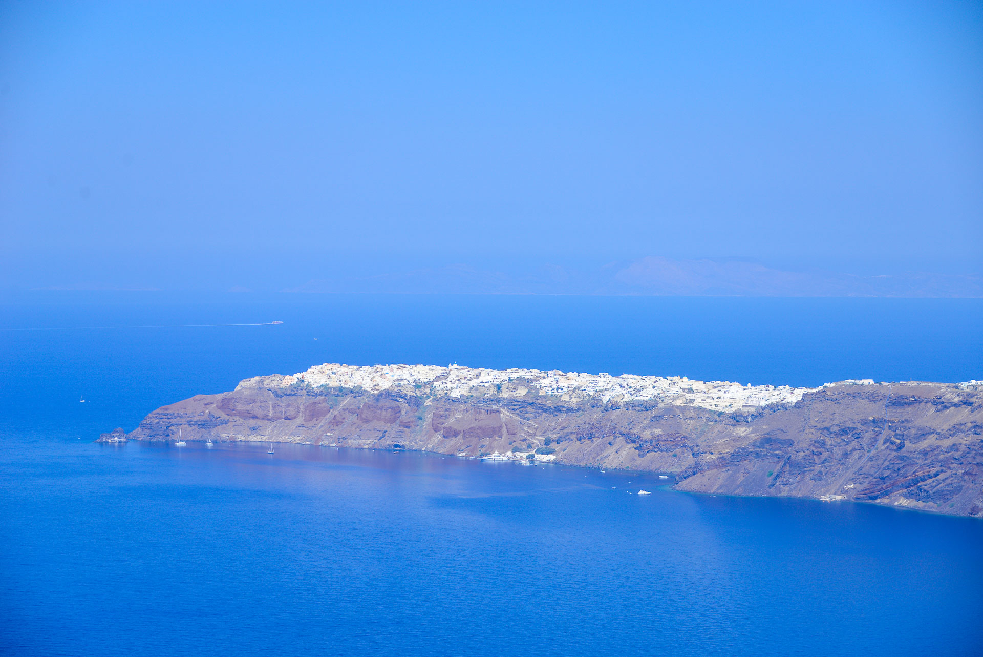
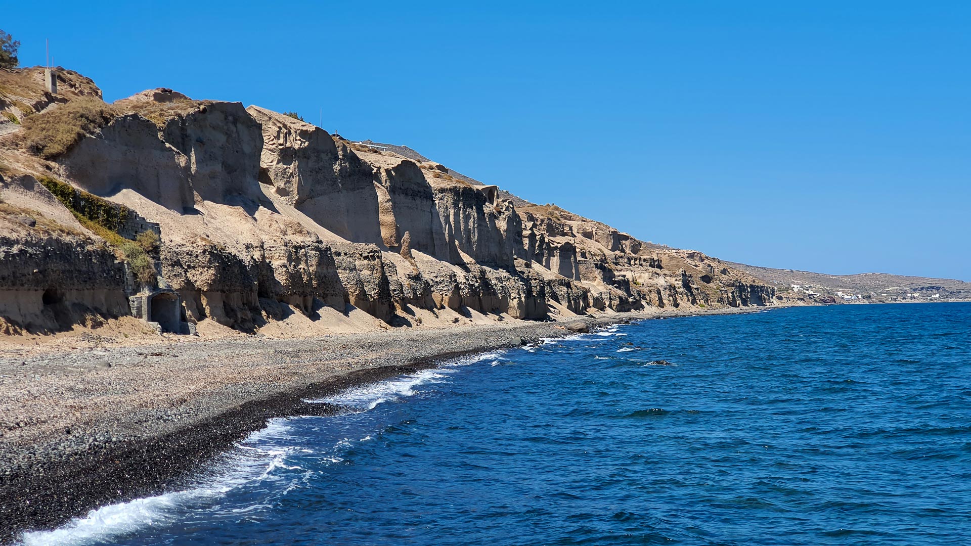
READ MORE »

Fira to Oia hike

The most famous trail on the island is the Fira – Oia trail. It runs along the caldera between the two most famous villages of Santorini. The road along the
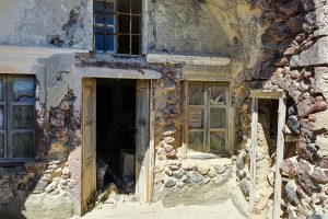
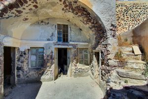
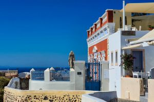
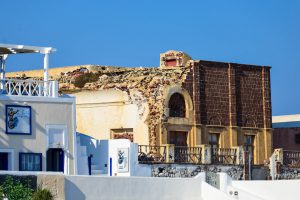
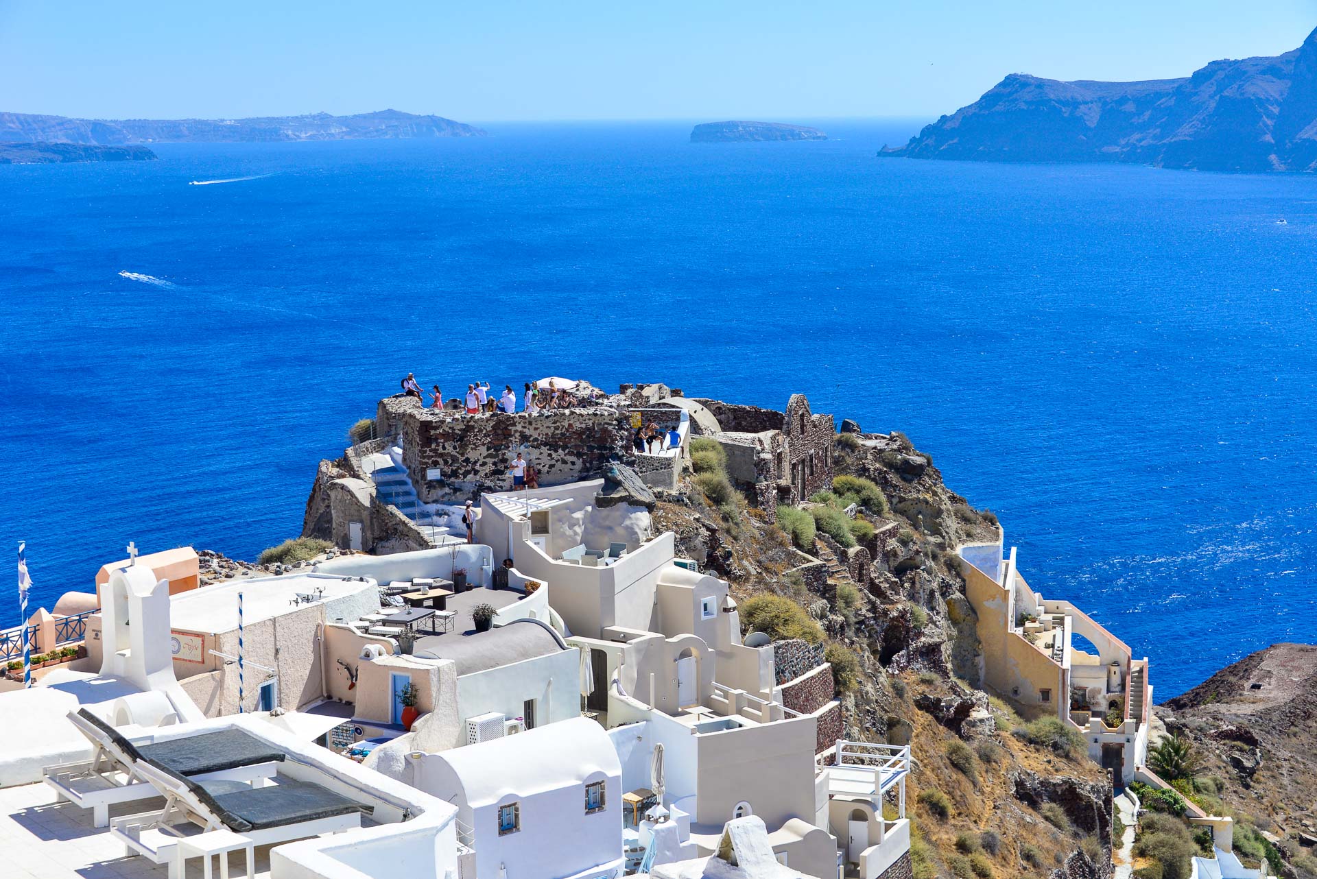
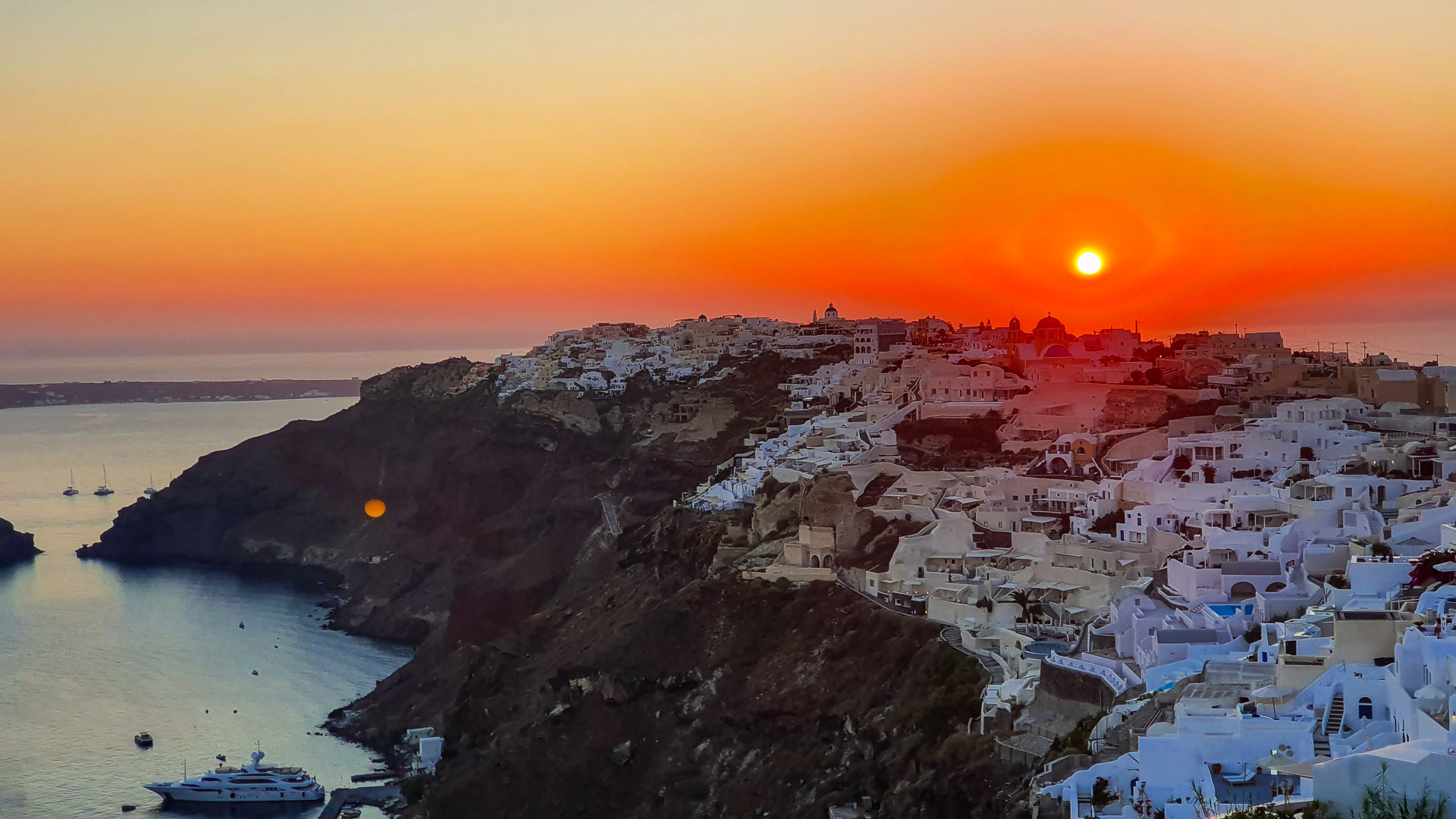
READ MORE »

Oia Castle

The ruins of the Venetian castle of Agios Nikolaos. Although not much remains of the castle, it is one of the biggest attractions of Santorini and one of the most popular and most crowded places to watch the famous Santorinian sunset.
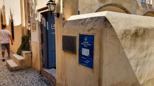
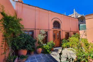
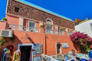
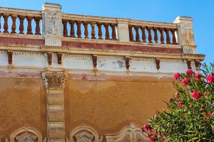
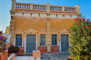
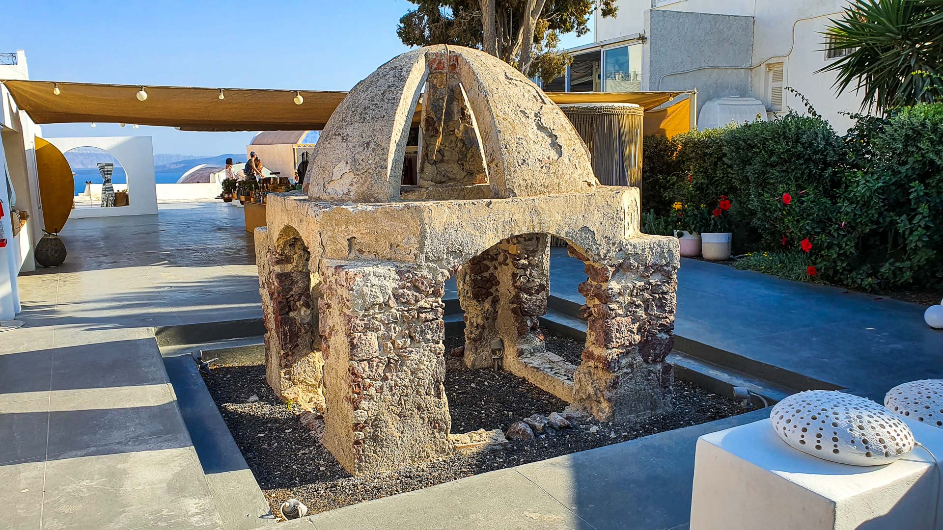
READ MORE »

Naval Museum in Oia

The museum was founded in 1956 by captain Antonis Dakoronias, who a few years earlier began collecting souvenirs related to the maritime history of Oi and Santorini.
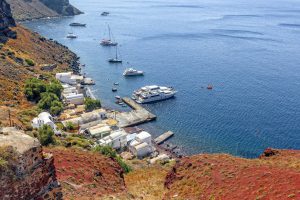
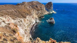
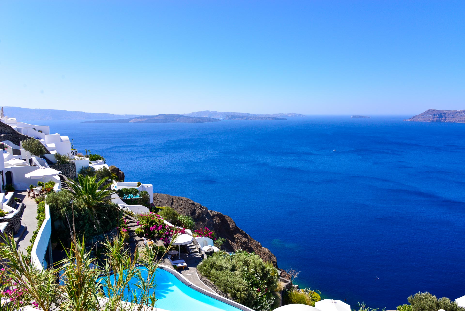
READ MORE »

Armeni Bay

Armeni is a port below Oia, on the Caldera side. In the glory days of Oia, Armeni was her main port. Large ships moored at some distance from the shore, and sailors reached it by small boats, so-called “Lantzes” (as it is currently the case with large cruise ships in the old port of Fira.)
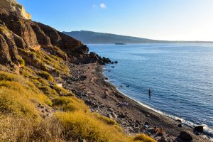
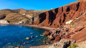
READ MORE »

Top beaches of Oia

Ammoudi Beach

Amoudi Beach

Ammoudi Beach is located south of the port of Ammoudi. This is not a typical beach with sand and umbrellas – more a fragment of the wild, rocky, volcanic coast. Perfect for diving enthusiasts. The water is slightly warmer than in other parts of the island, it is also characterized by higher sulfur concentration.
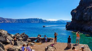
Read More »

Armeni Beach

Armeni is the former main port of Oia, but now mainly small boats and private yachts moor here. It is not a beach per se, but there is a descent and access to the sea, so some tourists take the opportunity to bathe. It is a small, rocky beach with large black and red rocks protruding from the sea.
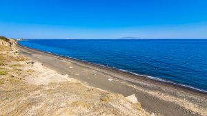
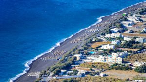
Read More »
Wide view of the Baxedes Beach

Baxedes Beach

Baxedes Beach (also known as Paradisos) is located on the northern coast of Santorini, east of Cape Mavropetra, at the height of Finikia. The name Baxedes comes from the Turkish word “Baxes”, which means “garden” (the locals grew vegetables and fruits such as tomatoes, cucumbers, peas, eggplants, carrots, zucchini, lettuce, and melons).

Read More »
Katharos Beach seen from above

Katharos Beach

Katharos Beach can be safely considered as one of the most beautiful beaches on the northwestern tip of the island. It is located just 1 km from Oia and can be accessed via a paved road that takes off from the route from Oia to Ammoudi Harbor.

Read More »

Architecture of Oia

The village was built on a steep slope descending into the sea from the caldera.

Oia is dominated by architecture typical of the entire Cyclades abounding in white houses, sometimes with a light blue finish (roofs, frames, shutters). What distinguishes the architecture at Oia is the fact that some of the buildings are painted in other colors – e.g. orange or salmon. The whole, against the backdrop of a raw, volcanic landscape creates a unique mosaic of colors.

Tight buildings are crossed by narrow (impassable to cars) streets. As on the whole island, we find many churches here – there are over 70 in Oia and the surrounding area.

Many houses have been built into the slope – they are located in tunnels hollowed out in the volcanic cliff of the caldera. These are the so-called Hyposkapha – houses belonging to the less prosperous inhabitants, usually terraced sailors, and people servicing ships.

Hyposkapha - Cave Houses

The Hyposkapha houses carved into the rock are long and narrow, with a semicircular vault. Their fronts are directed (according to the caldera arrangement) – to the south and west. Usually stacked, one above the other (a fragment of the roof of one house is often at the same time a courtyard of the other).

The bricked-in entrance opening is equipped with a door and a pair of windows – one on each side. Usually there is another small window above the door.

The apartment in the cave usually consisted of two rooms, arranged one after the other. The first (front) room served as a living room, and the second – a bedroom (sometimes in the back there were two bedrooms). The rooms were separated by a wall with doors and windows, that looked the same as the facade of the building. This provided access to daylight and fresh air to the interior room. Apart from the part located in the tunnel, sometimes there was an annex with a semi-circular roof near the house. The household also included a bathroom (with a separate entrance from the outside), a small kitchen (located at the back, of the main room – living room) and a utility room. The small courtyard, equipped with a rainwater tank, was surrounded by a low wall and decorated with flower beds.

It is believed that the first such houses on the island were built in the 7th century CE. They were of a defensive nature, and their construction was quite resistant to frequent earthquakes in this region.

The houses were raw, without decorative elements – the residents were mainly interested in obtaining a roof over their heads, they were less interested in the aesthetic value of the building. Usually, they built their houses on their own, from materials available on site, with a small amount of money.

Kapetanospita - Captain's Houses

Kapetanospita are a two-story residences for the elite inhabitants of Oia (mainly ship owners, among whom Oia was particularly popular) built at the turn of the century from local materials – mainly volcanic stones.

They stood out with richer architecture inspired by the Renaissance and neoclassical style, but with elements of local architecture woven in.

On the ground floor there was a kitchen, bedrooms, and utility rooms. On the first floor there was a beautifully furnished living room and a spacious terrace overlooking the sea. The gardens of the residence, usually surrounded by walls, were full of flowers.

The mansions had flat roofs to facilitate collecting rainwater, which flowed through special pipes into the tank – Cistern. In those days, collecting rainwater was the only way to obtain fresh water (there are no natural sources of drinking water near Oia).

Wine production took place in many homes, hence the additional rooms equipped with a special grape press. Some houses were additionally equipped with presses for squeezing tomatoes and mills for grinding fava peas.

Unfortunately, most homes of this type suffered severely in the 1956 earthquake. Some of them have been rebuilt, but some remain in ruins. In recent years, the Oia community has taken measures to rebuild and revitalize the ruined houses of the captain.

In one of these houses, at ul. March 25, 405 (exact address: 25ης Μαρτίου 405, Oia) is the Maritime Museum of Oia. In the remaining parts, there are restaurants and guesthouses.

History of Oia

Oia is a place with a long and rich history. The turn of the century is considered to be the time of the peak of its prosperity, and its economy was largely based on maritime trade – many owners of merchant ships lived in Oia.

  • the turn of the 11th and 12th centuries

    Oia is first mentioned in numerous travel diaries from this period

  • the end of the 15th century

    during the Venetian rule, the castle of Agios Nikolaos in Oia was built (one of five similar on the island) - more information: Castle of Agios Nikolaos in Oia

  • 1579

    The Duchy of Aegean (and with it Oia) was transferred to the Turks. Oia has been plagued by pirate attacks for decades

  • 1650

    outbreak of the underwater volcano Columbo (located northeast of Oia). Its volcanic activity, eruptions, ash bursts and the earthquakes that followed it lasted for two months.

  • 16th - 19th century

    Oia was marked on the maps as Apanomeria (Greek Απανωμερία)

  • late 19th century

    the economic boom of Oia

    Ships from Oia sailed throughout the Mediterranean, North, Black and Red Seas, as well as the Atlantic Ocean, sailing out of the Strait of Gibraltar. Traded with Western Europe, Russia, as well as the Middle East and Africa. The sea trade route between Alexandria and Russia played a particularly important role. One of the exported good was inland produced wine (among others to France).

    In 1890, Oia had about 2,500 inhabitants and about 130 sailing ships, making it the third city with the largest fleet in all of Greece. The port was in Armeni. - more information: Armeni Bay

  • the beginning of the 20th century

    a gradual decline in the importance of Oia, caused by the economic crisis, wars, and increased emigration of the local population. Maritime trade declined mainly due to the popularization of steam ships and the gradual increase in the importance of the port of Piraeus.

  • July 9, 1956

    an earthquake measuring 7.8 on the Richter scale destroyed a significant part of the town (the epicenter of the shock was just in the northern part of the island of Santorini, where Oia lies). Among others, the Castle of Agios Nikolaos, the churches of Panagia Platsani and Agios Georgios as well as many residential buildings collapsed. Some have not been rebuilt to this day.

  • 1960s and 1970s

    mass emigration of local people, mainly to Piraeus and Lavrio

  • the 1980s

    the gradual increase in the importance of Oia as a tourist attraction and the return of residents who had previously emigrated to other regions of Greece. The Greek Tourism Organization had undoubtedly contributed to the restoration of Oia's splendor, thanks to the efforts of which several dozen traditional buildings in the city were rebuilt.

Districts of Oia

Oia is not a big town, but we can distinguish several parts:

  • I Geitonia Ton Karavokyraion (Greek: Η Γειτονια Των Καραβοκυραιων) – literally translated “neighborhood of captains”, the northern part of the village, also called Sideras (Greek Σιδεράς). In this part of the city we can admire the residences of captains – Kapetanospita (read more: Kapetanospita), elegant villas in the Renaissance and neoclassical styles, belonging to the rich inhabitants of Oia, mainly ship owners.
  • I Geitonia Ton Pliromaton (Greek: Η Γειτονια Των Πληρωματων) – literally translated “neighborhood of the crews” – houses stretched along the caldera Hyposkapha (more information: Hyposkapha).
  • Fanári or Garmpiés Mýloi (Greek Φανάρι / Γαρμπινοί Μύλοι) – the part of Oia above the port of Ammoudi. The names come from the lighthouse located nearby (Fanári is literally a traffic light) and windmills (Μύλοι are mills). The most characteristic buildings in this district are the church of Agios Paraskevi and the church of Agios Aikaterini.
  • Goulas (Greek Γουλάς) – part of Oia, which now houses the castle ruins and the beginning of the stairs to the port of Amoudi. It is the oldest part of the village, a former Venetian district. It was destroyed during the earthquake in 1956. The name comes from the Turkish word “kulesi” meaning tower or observatory. The most characteristic buildings are the ruins of the castle, as well as the churches of Agios Pantes (from the caldera side), Taxiarches and Agia Triada (by the stairs to Ammoudi). A large part of the castle and the characteristic Panagia Platsani church collapsed during the 1956 earthquake.
  • Lótza (Greek Λότζα) – the central part of Oia running along the caldera. The name comes from the Italian word “loggia” meaning “lodge”. During the reign of Venetians there was a club for aristocrats in the area. Two characteristic churches – Agios Nikolaos and Panagia Metochi are located in this area.
  • Monastíri (Greek Μοναστήρι) – a part of the city located below the main square, from the side of the caldera. We can find there the churches of Agia Anastasis and Agios Spyridonas.
  • Perivolas (Greek Περίβολας) or I Geitonia Ton Agroton Tou Perivola (Greek Η Γειτονια Των Αγροτων Του Περιβολα – literally translated “the neighborhood of farmers Perivolas” – the district of Oia covering its eastern part (up to the border with Finikia). More information about the district: Perivolas

More information about Oia

Population and society of Oia

The number of permanent residents of Oia is about 1,500. In its heyday (1890), it was inhabited by 2,500 inhabitants, and in 1977 (two decades after the earthquake) – 306 inhabitants.

In the past, residents dealt mainly with professions related to sailing – they were sailors and ship builders. Currently, most residents work in tourism.

Name of the town

Oia received its current name in 1930.

Oia was formerly called Apano Meria (Απάνω Μεριά or Επάνω Μεριά, which means “upper side”). This name is still common (mainly among older, native inhabitants), usually as Pano Meria, and the inhabitants of Oia are sometimes called Apanomerites (Απανωμερίτες).

Tips and trivia

  • Oia is a city without power lines running above the ground – thanks to this nothing disturbs the beautiful views (as is often the case in other tourist places) and the city is even more photogenic.
  • Take a walk around Oia in the early morning to see it in all its glory, without crowds of tourists passing through it.
  • Most of the town is pedestrianized.


Frequently Asked Questions

What to do in Oia?

How far is Oia from Fira?

Oia is approximately 12 km (7.45 miles) from Fira (by car). The driving time between the villages is about 25 minutes.

The walking trail between the villages is about 10 km (6.21 miles) long and the walking time is between 2 and 4 hours.

Can you walk from Fira to Oia?

Yes, you can walk between the towns of Fira and Oia. A famous and popular trail leads between them along the caldera, considered by some people to be one of the most beautiful trails in the world. More information: Fira – Oia trail.

Where are the blue domes in Oia?

Most churches in Oia have blue domes. The most photographed churches with a blue dome in Oia are the churches of St Anastasia and Spiridon.

Other churches with a blue dome in Oia are:

  • St Nicholas Church – 36°27’39.30 “N, 25°22’26.60 “E
  • Church of St. Dmitri – 36°27’41.71 “N, 25°22’23.52 “E
  • Church of Panagia Platsani – 36°27’43.66 “N, 25°22’34.58 “E
  • Church of Nikolau Nomikou Street – 36°27’41.76 “N, 25°22’33.56”
  • Church of St. George in Perivolas – 36°27’42.93 “N, 25°23’0.91 “E

Is Oia in Santorini?

Yes, Oia is a village located in the north-west of Santorini and is one of the most popular and well-known destinations on the island.

Where to watch sunset in Oia?

Oia’s sunset can be viewed from many locations, including:

  • The car park at the Water Works,
  • The promenade at Perivolas – the entire length,
  • Promenade in Oia – the initial section,
  • By the churches of St Anastasia and Spiridon,
  • Oia Castle (the most besieged place, it is usually very crowded).

Weather in Oia

Check the weather forecast in Oia today and in the coming days.

Gallery of Oia

Explore Santorini with us

Discover it’s magical, unique beauty, it’s fascinating history and all of its attractions that draw millions of tourists every year from all around the world.